Langbahn Team – Weltmeisterschaft

File:Dera2001.jpg

Original file (1,395 × 1,527 pixels, file size: 1.04 MB, MIME type: image/jpeg)

Summary

Description
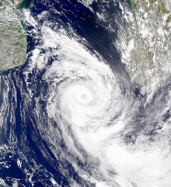
English: Cyclone Dera has moved to the southern end of the Mozambique Channel in this SeaWiFS image.
Date
Source http://visibleearth.nasa.gov/view_rec.php?id=1702
Author Provided by the SeaWiFS Project, NASA/Goddard Space Flight Center, and ORBIMAGE

Licensing

Public domain This image is from the Sea-viewing Wide Field-of-view Sensor (SeaWiFS) Project and more than 5 years old.

Satellite data captured by the SeaWIFS sensor are released into the public domain 5 years after capture. Data less than five years old can be re-used only for educational or scientific purposes; any commercial use of such images must be coordinated with GeoEye. [1]

Public domain This work has been released into the public domain by its copyright holder, GeoEye. This applies worldwide.
In some countries this may not be legally possible; if so:
GeoEye grants anyone the right to use this work for any purpose, without any conditions, unless such conditions are required by law.

Captions

Add a one-line explanation of what this file represents

Items portrayed in this file

depicts

copyright status

copyrighted, dedicated to the public domain by copyright holder

copyright license

released into the public domain by the copyright holder

inception

15 May 2001

File history

Click on a date/time to view the file as it appeared at that time.

Date/TimeThumbnailDimensionsUserComment
current19:43, 4 January 2020Thumbnail for version as of 19:43, 4 January 20201,395 × 1,527 (1.04 MB)Sandy14156Cropped and centered
19:16, 9 October 2010Thumbnail for version as of 19:16, 9 October 20101,978 × 2,682 (2.43 MB)Supportstormremoved noise
02:10, 21 March 2010Thumbnail for version as of 02:10, 21 March 20101,978 × 2,682 (2.43 MB)SupportstormLarger File
22:50, 16 December 2008Thumbnail for version as of 22:50, 16 December 2008370 × 579 (99 KB)Iune{{Information |Description={{en|1=Cyclone Dera has moved to the southern end of the Mozambique Channel in this SeaWiFS image.}} |Source=http://visibleearth.nasa.gov/view_rec.php?id=1702 |Author=NASA |Date=5-15-2001 |Permission= |other_versions= }} <!--{{

Metadata