
File:Clouth 20120710 000342 IMG 2177.jpg

Size of this preview: 800 × 600 pixels. Other resolutions: 320 × 240 pixels | 640 × 480 pixels | 1,024 × 768 pixels | 1,280 × 960 pixels | 2,592 × 1,944 pixels.
Original file (2,592 × 1,944 pixels, file size: 1.09 MB, MIME type: image/jpeg)
| Object location | | View this and other nearby images on: OpenStreetMap |
|---|
| Camera location | | View this and other nearby images on: OpenStreetMap |
|---|
Summary
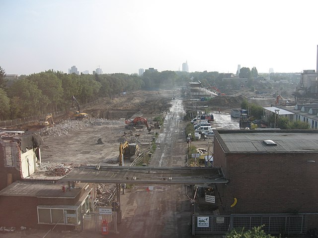
| Description | Deutsch: Das Bild ist Teil einer Zeitreihe die den Abriss der Clouth Gummiwerke in Köln-Nippes, sowie den Aufbau des neuen Clouth Quartiers an der selben Stelle dokumentiert. Die Zeitreihe erstreckt sich über 6 Jahre. Das Bild zeigt das Clouth Quartier vom ehemaligen Tor 4 der Clouth Werke am der Nord-Ost-Ende des Geländes. English: Image is part of an image sequence showing the deconstruction of Clouth-Gummiwerke in Cologne, Germany and the construction of the new Clout-Quarter in the same place. The image sequence spans a time of 6 years. The image show the Clouth-quarter from north-east end over the location of former gate 4. |
|||
| Date | (EXIF date information is very weak within this series. Please help to make dates more precise if you have additional information!) | |||
| Source | The author donates these pictures to the community for free use. He/she is personally known to me, but prefers not to be named as author. Upload to wikimedia and metadata documentation by Dr. Schorsch (talk) 17:25, 15 September 2019 (UTC) | |||
| Author | Photographer does not like to be named but is known to uploader. Dr. Schorsch (talk) 17:25, 15 September 2019 (UTC) | |||
| Permission (Reusing this file) |
|
File history
Click on a date/time to view the file as it appeared at that time.
| Date/Time | Thumbnail | Dimensions | User | Comment | |
|---|---|---|---|---|---|
| current | 17:22, 15 September 2019 | | 2,592 × 1,944 (1.09 MB) | Xorx | User created page with UploadWizard |
File usage
The following page uses this file:
Global file usage
The following other wikis use this file:
- Usage on de.wikipedia.org