
File:Asia 1200ad.jpg

Size of this preview: 800 × 494 pixels. Other resolutions: 320 × 198 pixels | 640 × 395 pixels | 1,024 × 632 pixels | 1,280 × 790 pixels | 1,968 × 1,215 pixels.
Original file (1,968 × 1,215 pixels, file size: 731 KB, MIME type: image/jpeg)
Summary

|
This historical map image could be re-created using vector graphics as an SVG file. This has several advantages; see Commons:Media for cleanup for more information. If an SVG form of this image is available, please upload it and afterwards replace this template with {{vector version available|new image name}}.
It is recommended to name the SVG file “Asia 1200ad.svg”—then the template Vector version available (or Vva) does not need the new image name parameter. |
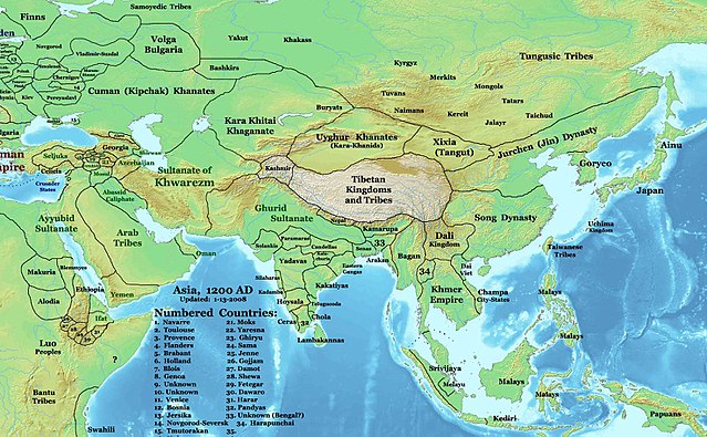
| Description | English: This image is a zoomed-in version of Eastern Hemisphere in 1200 AD updated 2008 (not correct).
Author: Thomas A. Lessman. Source URL: http://www.ThomasLessman.com/History/images/East-Hem_1200ad.jpg. Image was created by me (Thomas Lessman) based on map of Eastern Hemisphere in 1200AD. Image is free for public and/or educational use. I would appreciate a mention if this image is used elsewhere. If anyone is interested in helping further this work, please contact Thomas Lessman at talessman@yis.us. |
| Date | 3 December 2007 (original upload date) |
| Source | Transferred from en.wikipedia to Commons by Undead_warrior. |
| Author | Talessman at English Wikipedia |
Licensing
Talessman at English Wikipedia, the copyright holder of this work, hereby publishes it under the following licenses:

|
Permission is granted to copy, distribute and/or modify this document under the terms of the GNU Free Documentation License, Version 1.2 or any later version published by the Free Software Foundation; with no Invariant Sections, no Front-Cover Texts, and no Back-Cover Texts. A copy of the license is included in the section entitled GNU Free Documentation License. |
This file is licensed under the Creative Commons Attribution 3.0 Unported license.
Attribution: Talessman at English Wikipedia
- You are free:
- to share – to copy, distribute and transmit the work
- to remix – to adapt the work
- Under the following conditions:
- attribution – You must give appropriate credit, provide a link to the license, and indicate if changes were made. You may do so in any reasonable manner, but not in any way that suggests the licensor endorses you or your use.
You may select the license of your choice.
Original upload log
The original description page was here. All following user names refer to en.wikipedia.
- 2008-01-14 21:32 Talessman 1968×1215×8 (748875 bytes) Minor corrections based on info from DK Atlas of World History and other sources.
- 2008-01-11 21:51 Talessman 2076×1181×8 (764936 bytes) Fixed borders of central asia, India, southeast Asia, Indonesia, and Africa. Added more information.
- 2007-12-03 20:14 Talessman 2043×1308×8 (789102 bytes) This image is a zoomed-in version of [http://en.wikipedia.org/wiki/Image:East-Hem_1200ad.jpg Eastern Hemisphere in 1200 AD]. [[Image:East-Hem_1200ad.jpg|thumb|300px|left|Eastern Hemisphere in 1200 AD.]] Author: Thomas A. Lessman. Source URL: http://www.
File history
Click on a date/time to view the file as it appeared at that time.
| Date/Time | Thumbnail | Dimensions | User | Comment | |
|---|---|---|---|---|---|
| current | 04:32, 25 March 2008 | | 1,968 × 1,215 (731 KB) | Undead warrior | {{Information |Description={{en|This image is a zoomed-in version of [http://en.wikipedia.org/wiki/Image:East-Hem_1200ad.jpg Eastern Hemisphere in 1200 AD]. thumb|300px|left|Eastern Hemisphere in 1200 AD. Author: Thomas |
File usage
The following 5 pages use this file:
Global file usage
The following other wikis use this file:
- Usage on an.wikipedia.org
- Usage on ar.wikipedia.org
- Usage on arz.wikipedia.org
- Usage on ast.wikipedia.org
- Usage on ba.wikipedia.org
- Usage on bn.wikipedia.org
- Usage on bs.wikipedia.org
- Usage on ca.wikipedia.org
- Usage on ceb.wikipedia.org
- Usage on de.wikipedia.org
- Usage on el.wikipedia.org
- Usage on eo.wikipedia.org
- Usage on es.wikipedia.org
- Usage on fa.wikipedia.org
View more global usage of this file.