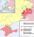
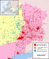
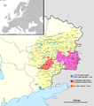
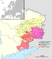
File:2014 Russo-ukrainian-conflict map.svg

Size of this PNG preview of this SVG file: 552 × 599 pixels. Other resolutions: 221 × 240 pixels | 442 × 480 pixels | 707 × 768 pixels | 943 × 1,024 pixels | 1,886 × 2,048 pixels | 4,126 × 4,480 pixels.
Original file (SVG file, nominally 4,126 × 4,480 pixels, file size: 2.75 MB)
File history
Click on a date/time to view the file as it appeared at that time.
| Date/Time | Thumbnail | Dimensions | User | Comment | |
|---|---|---|---|---|---|
| current | 16:03, 9 October 2014 |  | 4,126 × 4,480 (2.75 MB) | Mondolkiri1 | Marinka and Novotroitske - http://militarymaps.info/ |
| 03:27, 9 October 2014 |  | 4,126 × 4,480 (2.75 MB) | Mondolkiri1 | Update according to http://militarymaps.info/ and other sources provided in File:East Ukraine Conflict.svg | |
| 23:30, 6 October 2014 |  | 4,126 × 4,480 (2.74 MB) | Mondolkiri1 | Corrected Zolote and added Novoslapa | |
| 23:20, 6 October 2014 |  | 4,126 × 4,480 (2.74 MB) | Mondolkiri1 | Update according to http://militarymaps.info/ , http://www.segodnya.ua/regions/donetsk/moskal-boeviki-obyavili-na-menya-ohotu-558223.html and other sources in my talk page | |
| 07:13, 5 October 2014 |  | 4,126 × 4,480 (2.74 MB) | Mondolkiri1 | Update Donbass according to File:East Ukraine Conflict.svg | |
| 17:50, 19 September 2014 |  | 4,126 × 4,480 (2.73 MB) | Hanibal911 | POV Vandalism I revert all unjustified changes which was made based unreliable sources | |
| 07:46, 19 September 2014 |  | 4,126 × 4,480 (2.71 MB) | Niele~commonswiki | - Added Lutuhyne tot the red area as suggested by user Mondolkiri1 - Updated legenda and unclear/conflicting report-colours. This was a constructive way to prevent discussions, edit warring on basis of conflicting sources | |
| 13:26, 18 September 2014 |  | 4,126 × 4,480 (2.73 MB) | Hanibal911 | POV Pushing we not use this not correct maps which contradicts to many sources | |
| 13:01, 18 September 2014 |  | 4,126 × 4,480 (2.7 MB) | Niele~commonswiki | Not true, http://mediarnbo.org/ is the official communication-website of Ukrainean Forces, while http://liveuamap.com is unofficial map hosted from the us.Reverted to version as of 12:40, 18 September 2014 | |
| 12:44, 18 September 2014 |  | 4,126 × 4,480 (2.73 MB) | Mondolkiri1 | Reverted to version as of 12:32, 18 September 2014 Sorry, but the http://liveuamap.com/ is the official Ukrainian ATO site, and as I said, Lutuhyne is in the pink area there, not in the foggy zone! |
File usage
The following 9 pages use this file:
Global file usage
The following other wikis use this file:
- Usage on af.wikipedia.org
- Usage on bn.wikipedia.org
- Usage on cs.wikipedia.org
- Usage on de.wikipedia.org
- Usage on fi.wikipedia.org
- Usage on he.wikipedia.org
- Usage on incubator.wikimedia.org
- Usage on it.wikiquote.org
- Usage on ja.wikipedia.org
- Usage on ka.wikipedia.org
- Usage on lv.wikipedia.org
- Usage on mk.wikipedia.org
- Usage on ne.wikipedia.org
- Usage on nl.wikipedia.org
- Usage on pt.wikipedia.org
- Usage on ru.wikinews.org
- Usage on ru.wikiquote.org
- Usage on sd.wikipedia.org
- Usage on te.wikipedia.org
- Usage on uk.wikipedia.org
- Usage on uk.wikiquote.org
- Usage on vi.wikipedia.org


