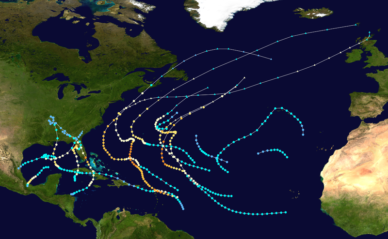
File:1950 Atlantic hurricane season summary map.png

Size of this preview: 800 × 494 pixels. Other resolutions: 320 × 198 pixels | 640 × 396 pixels | 1,024 × 633 pixels | 1,280 × 791 pixels | 3,000 × 1,854 pixels.
Original file (3,000 × 1,854 pixels, file size: 4.04 MB, MIME type: image/png)
File history
Click on a date/time to view the file as it appeared at that time.
| Date/Time | Thumbnail | Dimensions | User | Comment | |
|---|---|---|---|---|---|
| current | 23:02, 25 March 2014 |  | 3,000 × 1,854 (4.04 MB) | Supportstorm | HURDAT update |
| 17:57, 9 June 2013 |  | 3,000 × 1,854 (3.74 MB) | Supportstorm | {{Hurricane season auto track map|start=|end=|source=ATL|type=hurricane|basin=Atlantic|year=1950|author=Supportstorm}} |
File usage
The following 7 pages use this file:
Global file usage
The following other wikis use this file:
- Usage on de.wikipedia.org
- Usage on es.wikipedia.org
- Usage on fi.wikipedia.org
- Usage on pt.wikipedia.org
- Usage on www.wikidata.org
- Usage on zh.wikipedia.org
