
File:GJohnsonMap Purchase.jpg

Size of this preview: 800 × 600 pixels. Other resolutions: 320 × 240 pixels | 640 × 480 pixels | 1,024 × 768 pixels.
Original file (1,024 × 768 pixels, file size: 267 KB, MIME type: image/jpeg)
Summary
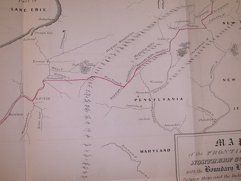
Fragment of Guy Johnson's map of the Line of Property 1768; Purchase Line between Kittanning and Cherry Tree, PA
Licensing
File history
Click on a date/time to view the file as it appeared at that time.
| Date/Time | Thumbnail | Dimensions | User | Comment | |
|---|---|---|---|---|---|
| current | 13:26, 31 December 2005 | | 1,024 × 768 (267 KB) | Blauwkoe (talk | contribs) | Fragment of Guy Johnson's map of the Line of Property 1768; Purchase Line between Kittanning and Cherry Tree, PA |
You cannot overwrite this file.
File usage
The following page uses this file: