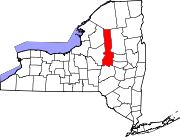
East Frankfort, New York
East Frankfort, New York | |
|---|---|
| Coordinates: 43°1′16″N 75°3′28″W / 43.02111°N 75.05778°W | |
| Country | United States |
| State | New York |
| County | Herkimer |
| Town | Frankfort |
| Area | |
• Total | 0.79 sq mi (2.05 km2) |
| • Land | 0.79 sq mi (2.05 km2) |
| • Water | 0.00 sq mi (0.00 km2) |
| Elevation | 420 ft (128 m) |
| Population (2020) | |
• Total | 496 |
| • Density | 626.26/sq mi (241.70/km2) |
| Time zone | UTC-5 (Eastern (EST)) |
| • Summer (DST) | UTC-4 (EDT) |
| ZIP Code | 13357 (Ilion) |
| Area code(s) | 315/680 |
| FIPS code | 36-22029 |
| GNIS feature ID | 2806939[2] |
East Frankfort is a hamlet and census-designated place (CDP) in the town of Frankfort in Herkimer County, New York. It was first listed as a CDP prior to the 2020 census.[2]
History
The hamlet was founded in 1854 by Archibald C. McGowan and was originally known as "McGowansville".
Geography
The community is in western Herkimer County, on the eastern edge of the town of Frankfort. It is bordered to the east by the town of German Flatts and the village of Ilion. The village of Frankfort is 1 mile (1.6 km) to the north.
New York State Route 5S, a limited-access highway, forms the northern edge of the CDP, with access from Acme Road/West Main Street at the northeast corner of the community. Route 5S leads east past Ilion 3 miles (5 km) to Mohawk and northwest 11 miles (18 km) to Utica.
Demographics
| Census | Pop. | Note | %± |
|---|---|---|---|
| 2020 | 496 | — | |
| U.S. Decennial Census[3] | |||
References
- ^ "ArcGIS REST Services Directory". United States Census Bureau. Retrieved September 20, 2022.
- ^ a b "East Frankfort Census Designated Place". Geographic Names Information System. United States Geological Survey, United States Department of the Interior.
- ^ "Census of Population and Housing". Census.gov. Retrieved June 4, 2016.


