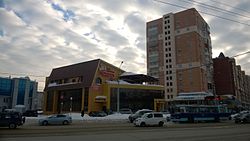
Dzerzhinsky District, Novosibirsk
Dzerzhinsky City District | |
|---|---|
 | |
 Location of Dzerzhinsky City District | |
| Coordinates: 55°4′0″N 83°0′0″E / 55.06667°N 83.00000°E | |
| Country | Russia |
| Federal subject | Novosibirsk |
| Established | 1 October 1933 |
| Area | |
• Total | 36.51 km2 (14.10 sq mi) |
Dzerzhinsky City District (Russian: Дзержинский район) is an administrative district (raion), one of the 10 raions of Novosibirsk, Russia. The area of the district is 36,51 km2 (14.10 sq mi).[1] Population: 174,360 (2018 Census).[2]
History
In 1933, the Dzerzhinsky District was established.[1]
In 1980, part of the Dzerzhinsky City District became the Kalininsky City Distinct.[1]
Geography
Bodies of water
Architecture
Soviet architecture
Parks
Beryozovaya Roshcha
Beryozovaya Roshcha is a park, established in 1963. Its area is 30 hectares.[3]
Dzerzhinsky Park
Science and education
Research Institutes
Educational institutions
- Novosibirsk Construction and Assembly College
- Novosibirsk Radio Engineering College
- College of Light Industry and Service
- Kondratyuk Aerospace Lyceum
Libraries
- Chklov Library
- Gashek Library
- Gogol Library
- Ostrovsky Library
- Tsvetayeva Library
- Turgenev Library
Culture
Cultural organizations
- Children's House of Culture named after Kalinin
- Eurasia (concert and theatrical center)
- Palace of Culture named after Chkalov
- Tochmashovets House of Culture
Dance
- Fraules Dance Centre is a dance school of Elena Yatkina.[4]
Sports
- Chkalovets Stadium
- Novosibirsk Biathlon Complex is a sports complex in the east of the district.
Economy
Companies
- Novosibirsk Aircraft Production Association. Its produces Su-34 fighter-bombers, An-38-120 regional passenger aircraft. The company also involved in the Sukhoi Superjet 100 program.
- Maskulo is a fetish clothing company for men founded in 2014.[5]
Transportations
Bus and trolleybus
Tram
Railway
Novosibirsk-Vostochny Railway Station is located in the district.
Metro
Two Novosibirsk Metro stations are located in the district: Beryozovaya Roshcha and Zolotaya Niva.
- Beryozovaya Roshcha
References
- ^ a b c d The Novosibirsk government. Official site.
- ^ "Novosibirsk Oblast Territorial Branch of the Federal State Statistics Service. Численность населения по муниципальным районам и городским округам Новосибирской области на 1 января 2018 года и в среднем за 2017 год" (PDF). Archived from the original (PDF) on 2018-08-23. Retrieved 2018-09-08.
- ^ Парк культуры и отдыха «Березовая роща». Новосибирский краеведческий портал. Beryozovaya Roshcha Park. Novosibirsk Local History Portal.
- ^ Beyonce's choreographer Danielle Polanco checks out Siberia's twerking sensations. The Siberian Times.
- ^ Илья Калинин. ЛГБТ-активист из Новосибирска открыл в Берлине магазин фетиш-одежды. НГС.НОВОСТИ.


