Dali District
Dali 大里區 Ōsato | |
|---|---|
| Dali District | |
 Taichung Software Park in Dali District | |
 Location in Taichung | |
| Country | Taiwan |
| Special municipality | Taichung |
| Area | |
• Total | 28.88 km2 (11.15 sq mi) |
| Population (February 2023) | |
• Total | 211,861 |
| Time zone | UTC+8 |
| Website | www |

Dali District (Chinese: 大里區; pinyin: Dàlǐ Qū) is an inner city district in Taichung, Taiwan.
Name
The name "Dali" originates from Tai-li-khit (Chinese: 大里杙; Pe̍h-ōe-jī: Tāi-lí-khi̍t), where Tai-li refers to the Hoanya aborigines and khit refers to a bamboo raft's toon.[1]: 75 The word "khit" (Chinese: 杙; Pe̍h-ōe-jī: Khi̍t) means a tiny wooden post, referring to the time as a port city.[2]
History
After the handover of Taiwan from Japan to the Republic of China in 1945, Dali was organized as a rural township of Taichung County.[1]: 121 On 1 November 1993, Dali was upgraded to a county-administered city due to its population.[1]: 122 On 25 December 2010, Taichung County was merged with Taichung City and Dali was upgraded to a district of the city. [3]: 3
Administrative divisions
The current administrative divisions can be traced back to the 1920s under the Japanese administration, during which the local government set the village, (Ōsato village (大里庄, Ōsato sō)), under the Taiton district, Taichū Shyō (臺中州, Taichū Shyō) (Taichung today). [4]: 388
At first, the village has eight villages. [4]: 389 After the handover of Taiwan from Japan, it has changed into Dali Township (大里鄉) under Taichung Country. On November 1, 1993, Dali Township changed into Dali City (大里市). [4]: 392 In 2010, the city was renamed into Dali District under the newly founded Taichung City. [3]: 3
There are 27 villages with 767 alleys in the district. Each villages are:[5][3]: 3
Tunghu, Xihu, Dali, Xinli, Guoguang, Shuwang, Xiangxing, Neixin, Zhongxin, Tungsheng, Dayuan, Jiatian, Renhua, Rende, Jianmin, Tucheng, Tungxing, Daming, Yonglong, Rixin, Xirong, Zhangrong, Jincheng, Liren, Lide, Xinren and Ruicheng Village.
Education
Universities
Junior high schools
Senior high schools
- The Affiliated Senior High School of National Chung Hsing University
- Taichung county of Dali senior High School
- Ta ming senior High School
- Chito tai senior High School
- Youth senior High School
- Lizen senior High School
Economy
Tourist attractions
- Museum of Fiber Arts, Taichung
- Taichung software park Dali art plaza
- Daliyi old street
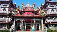
- Daliyi Fuxing Temple
- Mayfun Taro ice
- Taichung City Dali Civil Sports Center
Transportation
- NH3(209)
- Provincial Highway No.3
- Provincial Highway No.63
- Provincial Highway No.74
- County route No.129
Hospital
- Jen-Ai Hospital
- Bodhi Hospital
- Wufeng Cheng Ching Hospital
References
- ^ a b c 邱正略, ed. (November 2012). 《大里市史·第一篇·沿革篇》 (in Chinese (Taiwan)). 臺中市: 臺中市大里區公所.
- ^ "認識大里-歷史沿革" (in Chinese (Taiwan)). 臺中市大里區公所. 2012-07-11. Archived from the original on 2020-10-22. Retrieved 2021-02-12.
- ^ a b c "看見大里杙" (PDF) (in Chinese (Taiwan)). 臺中市大里區公所. 2017. Archived (PDF) from the original on 2021-10-10. Retrieved 2021-02-27.
- ^ a b c 曾鼎甲, ed. (November 2012). 《大里市史·第三篇·政事篇》 (in Chinese (Taiwan)). 臺中市: 臺中市大里區公所.
- ^ "機關介紹-里長名冊" (in Chinese (Taiwan)). 臺中市大里區公所. Archived from the original on 2023-01-23. Retrieved 2023-01-22.
