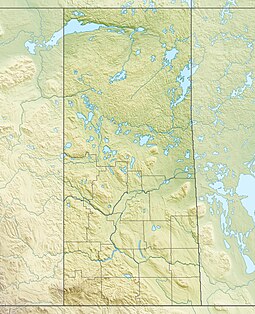
Boggy Creek (Saskatchewan)
| Boggy Creek | |
|---|---|
 The Red River drainage basin, with the Qu'Appelle River highlighted | |
| Location | |
| Country | Canada |
| Provinces | Saskatchewan |
| Physical characteristics | |
| Source | |
| • location | RM of South Qu'Appelle No. 157 |
| • coordinates | 50°32′41″N 104°12′28″W / 50.5447°N 104.2078°W |
| Mouth | Qu'Appelle River |
• location | RM of Lumsden No. 189 |
• coordinates | 50°39′48″N 104°49′52″W / 50.6633°N 104.8311°W |
• elevation | 497 m (1,631 ft) |
| Basin features | |
| River system | Qu'Appelle River drainage basin |
| Tributaries | |
| • right | Seibel Creek |
Boggy Creek[1] is a river in the Canadian province of Saskatchewan. The river begins north-east of Balgonie and heads in a westerly direction towards Pilot Butte and Regina before turning north-west where it meets the Qu'Appelle River east of Lumsden.[2] Along the river's course there is a reservoir and several tourist attractions including parks, golf courses, a race track, and a summer camp.
Course
Boggy Creek begins in the Rural Municipality of South Qu'Appelle No. 157 about 10 kilometres (6.2 mi) north-east of Balgonie near Highway 10. From its source, it heads west crossing Highway 364 before dropping south for about 1.5 km (0.93 mi). It then returns to its westerly flow skirting the northern edge of Pilot Butte. West of Pilot Butte is Murray Parkway Golf Course, Kings Park Speedway, and Tor Hill Golf Course.[3] From Tor Hill Golf Course, Boggy Creek heads in a north-westerly direction crossing Highway 6 then Highway 11 before emptying into Condie Reservoir[4] in Condie Nature Refuge. From the lake, the river carries on past Boggy Creek School heritage site,[5] Flowing Springs Golf Greens,[6] Dallas Valley Ranch Camp,[7] and Happy Hollow Corn Maze[8] before flowing into the Qu'Appelle River about 2 km (1.2 mi) down stream and east of Lumsden.[9]
Condie Nature Refuge
Condie Nature Refuge (50°33′41″N 104°42′55″W / 50.5613°N 104.7153°W)[10] is a provincial recreation site encompassing Condie Reservoir along the course of Boggy Creek in the RM of Sherwood No. 159. Condie Reservoir was constructed in 1924 to supply water for steam engines travelling through Regina. The park is open year-round and has a picnic area, hiking trails, and access to the lake for fishing.[11] Fish found in this 3.8 m (12 ft) deep, 67.4 ha (167 acres) lake include northern pike and yellow perch.[12][13] Wildflowers such as wild roses, gaillardia, and western red lilies are found in the park. It is also home to birds such as pelicans, hawks, ducks, and swallows. Access is from Highway 734.
See also
References
- ^ "Boggy Creek". Canadian Geographical Names Database. Government of Canada. Retrieved 14 May 2023.
- ^ "Boggy Creek". Geoview. Geoview. Retrieved 14 May 2023.
- ^ "Golf Courses". Regina. City of Regina. Retrieved 15 May 2023.
- ^ "Condie Reservoir". Canadian Geographical Names Database. Government of Canada. Retrieved 14 May 2023.
- ^ "Boggy Creek School". Canada's Historic Places. Parks Canada. Retrieved 14 May 2023.
- ^ "Flowing Springs Golf Greens". GolfPass. GolfPass. Retrieved 14 May 2023.
- ^ "Welcome to Dallas Valley". Dallas Valley. Dallas Valley Ranch Camp. Retrieved 15 May 2023.
- ^ "Happy Hollow". Happy Hollow. Happy Hollow. Retrieved 15 May 2023.
- ^ "Boggy Creek, Saskatchewan Map". Geodata.us. Geodata.us. Retrieved 14 May 2023.
- ^ "Condie Nature Refuge Recreation Site". Canadian Geographical Names Database. Government of Canada. Retrieved 14 May 2023.
- ^ "Regina - Condie Nature Refuge". Tourism Saskatchewan. Government of Saskatchewan. Retrieved 14 May 2023.
- ^ "Condie Reservoir Fishing Map". GPS Nautical Charts. Bist LLC. Retrieved 15 May 2023.
- ^ "Condie Reservoir". Angler's Atlas. Angler's Atlas. Retrieved 15 May 2023.


