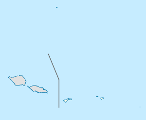
ʻAuʻasi, American Samoa
ʻAuʻasi | |
|---|---|
Village | |
| Coordinates: 14°16′36″S 170°34′28″W / 14.27667°S 170.57444°W | |
| Country | |
| Territory | |
| Area | |
• Total | 0.26 sq mi (0.67 km2) |
| Population (2020) | |
• Total | 88 |
| • Density | 340/sq mi (130/km2) |
ʻAuʻasi is a village in the east of Tutuila Island, American Samoa. One of the island's more populous villages, it is located on the south coast, close to the eastern tip of the island and to the smaller offshore island of Aunuʻu. It is located in Saʻole County.
Above the village is a waterfall known as ʻAuʻasi Falls. This can be visited by following the stream in ʻAuʻasi for about 30 minutes. It is particularly impressive after heavy rain.[1]
Ferries for Aunu'u Island leave from the dock at ʻAuʻasi. ʻAuʻasi is located roughly one mile from Aunu'u Island and is therefore the closest land area to Aunu'u on Tutuila Island.[2]
Geography
ʻAuʻasi is a village situated on the southeastern coast of Tutuila Island, in Saʻole County in the Eastern District. Approximately 15 road miles from Pago Pago Harbor, Auasi lies in a shallow bay nestled between Taugamalama Point and Maatu'aume Point. The village is 1.2 miles from Aunu'u Island, serving as the traditional landing site for its residents. ʻAuʻasi covers a relatively flat area of around 10 acres, with land elevations between 8 and 12 feet above sea level. The terrain consists of coastal terraces formed by stream erosion and sediment deposits, underlain by silt to boulder-sized sediments derived from the offshore reef. Coral limestone sand and gravel are present along the shoreline, gradually transitioning into steep cliffs below the beach.[3]
As the primary gateway for Aunuʻu Island, ʻAuʻasi plays a pivotal role in daily commutes and logistics. Residents of Aunuʻu rely on longboats and small motorboats to travel between the island and ʻAuʻasi for education, work, and access to markets in Pago Pago. The village supports agricultural activities, with crops like taro, breadfruit, and citrus transported to the markets in Pago Pago.[4]
Demographics
| Year | Population[5] |
|---|---|
| 2020 | 88 |
| 2010 | 113 |
| 2000 | 125 |
| 1990 | 122 |
| 1980 | 117 |
| 1970 | 74 |
| 1960 | 43 |
References
- ^ Swaney, Deanna (1994). Samoa: Western & American Samoa: a Lonely Planet Travel Survival Kit. Lonely Planet Publications. Page 178. ISBN 9780864422255.
- ^ Faiʻivae, Alex Godinet (2018). Ole Manuō o Tala Tuʻu Ma Fisaga o Tala Ave. Amerika Samoa Humanities Council. ISBN 978-1546229070.
- ^ U.S. Army Corps of Engineers (1978). “Auasi Harbor for Light Draft Vessels, Tutuila Island: Environmental Impact Statement”. Northwestern University.
- ^ U.S. Army Corps of Engineers (1978). “Auasi Harbor for Light Draft Vessels, Tutuila Island: Environmental Impact Statement”. Northwestern University.
- ^ "American Samoa Statistical Yearbook 2016" (PDF). American Samoa Department of Commerce. Archived from the original (PDF) on 2019-02-14. Retrieved 2019-07-25.

