
Datei:Põlvamaa lipp.svg

Größe der PNG-Vorschau dieser SVG-Datei: 471 × 300 Pixel. Weitere aus SVG automatisch erzeugte PNG-Grafiken in verschiedenen Auflösungen: 320 × 204 Pixel | 640 × 408 Pixel | 1.024 × 652 Pixel | 1.280 × 815 Pixel | 2.560 × 1.631 Pixel
Originaldatei (SVG-Datei, Basisgröße: 471 × 300 Pixel, Dateigröße: 9 KB)
![]()
Diese Datei und die Informationen unter dem roten Trennstrich werden aus dem zentralen Medienarchiv Wikimedia Commons eingebunden.
![]()
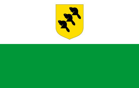
Eesti: Põlvamaa lipp
Deutsch: Wappen des Kreises Põlva
English: Flag of Põlva County, Estonia
Русский: Флаг Пылвамаа
Svenska: Põlva läns flagga
Allikas: http://www.riigikantselei.ee/

|
Das Bild dieser Flagge lässt sich leicht mit einem Rahmen versehen :
[[File:Põlvamaa lipp.svg|border|96x176px]] |
Gemäß § 5, Satz 1-8 des Urheberrechtsgesetzes der Republik Estland (verabschiedet am 11. November 1992 sowie überarbeitet am 9. Dezember 1999 und 15. Februar 2000) trifft auf folgende intellektuelle Tätigkeiten kein Urheberrecht zu:
|
 |
Dateiversionen
Klicke auf einen Zeitpunkt, um diese Version zu laden.
| Version vom | Vorschaubild | Maße | Benutzer | Kommentar | |
|---|---|---|---|---|---|
| aktuell | 17:24, 19. Apr. 2021 | | 471 × 300 (9 KB) | Dughorm | Colors from https://www.riigiteataja.ee/aktilisa/1231/2201/7039/Lisa_23.pdf |
| 00:29, 4. Mär. 2007 |  | 471 × 300 (9 KB) | Urmas | ||
| 23:08, 5. Jan. 2007 |  | 471 × 300 (9 KB) | Urmas | ||
| 22:21, 5. Jan. 2007 |  | 471 × 300 (8 KB) | Urmas |
Dateiverwendung
Die folgenden 21 Seiten verwenden diese Datei:
- Ahja
- Kanepi
- Kõlleste
- Laheda
- Leuchtturm Mehikoorma
- Liste der Gemeinden in Estland
- Liste von Leuchttürmen in Estland
- Mikitamäe
- Mooste
- Orava (Gemeinde)
- Põlva (Gemeinde)
- Põlva (Põlva)
- Räpina
- Räpina (Räpina)
- Valgjärve
- Vastse-Kuuste
- Veriora
- Värska
- Wikipedia:Vorlagen subnationaler Einheiten mit Flagge
- Vorlage:EE-65
- Vorlage:Info ISO-3166-2:EE-64
Globale Dateiverwendung
Die nachfolgenden anderen Wikis verwenden diese Datei:
- Verwendung auf ar.wikipedia.org
- Verwendung auf az.wikipedia.org
- Verwendung auf ba.wikipedia.org
- Verwendung auf be-tarask.wikipedia.org
- Verwendung auf be.wikipedia.org
- Verwendung auf bs.wikipedia.org
- Verwendung auf ca.wikipedia.org
- Verwendung auf ceb.wikipedia.org
- Verwendung auf ce.wikipedia.org
- Verwendung auf ckb.wikipedia.org
- Verwendung auf cs.wikipedia.org
- Verwendung auf cv.wikipedia.org
- Verwendung auf da.wikipedia.org
- Verwendung auf el.wikipedia.org
- Verwendung auf en.wikipedia.org
- Municipalities of Estonia
- Põlva County
- Orava Parish
- Flags of counties of Estonia
- Template:Põlvamaa
- List of Estonian flags
- List of political and geographic subdivisions by total area (all)
- List of political and geographic subdivisions by total area from 1,000 to 3,000 square kilometers
- List of political and geographic subdivisions by total area from 1,000 to 5,000 square kilometers
- Template:Country data Põlvamaa
- Ahja Parish
- Kanepi Parish
- Kõlleste Parish
- Laheda Parish
- Mikitamäe Parish
- Mooste Parish
- Põlva Parish
- Räpina Parish
- Valgjärve Parish
- Värska Parish
- Vastse-Kuuste Parish
- Veriora Parish
- Tõdu
- Category:Kanepi Parish
- Category:Põlva Parish
- Category:Räpina Parish
- Template:Põlvamaa-cat
- Category:Populated places in Põlva County
- User:Cow me, please!
- User:TolleWurst/Flags of countries and country subdivisions
- Category:Räpina
Weitere globale Verwendungen dieser Datei anschauen.