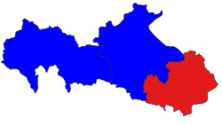
Zalun Township
Zalun Township ဇလွန်မြို့နယ် | |
|---|---|
 Location in Hinthada district | |
| Coordinates: 17°25′N 95°34′E / 17.417°N 95.567°E | |
| Country | |
| Division | Ayeyawady Division |
| District | Hinthada District |
| Capital | Zalun |
| Time zone | UTC+6:30 (MST) |
Zalun Township (Burmese: ဇလွန်မြို့နယ်) is a township of Hinthada District in the Ayeyarwady Division of Myanmar. The township consists of Zalun town, which has five wards,[1] and 462 villages.[citation needed]
Demographics as of 2014
The township had a population of 168,203. Literacy rates were claimed to be greater than 95%. The labor participation rate was around 68% for men and women. Most residents own their homes, typically constructed of bamboo, corrugated sheets, other wood and leaves. Cooking is typically with firewood powered cooking stoves. Most residents had access to improved water sources like bored wells. Most residents of the township are Buddhist, with small populations of Christians and Muslims.[1]
Towns and villages
- Amyet
- Apyauk
- Chaunggyi
- Danube
- Daunggyi
- Gamonzu
- Gonnyindan
- Gwetkyi
- Hna-eindan
- Htonput
- Ingade
- Inswet
- Kanugale
- Kanugyi
- Kanyinkwin
- Kawt Kat
- Kawt Sein
- Kya-in
- Kyaungzu
- Kyongyaik
- Kyonsha
- Khin Pyae
- Kyon-Zayit
- Kywepaganchaung
- Leikkonzu
- Le-u
- Manyeinzu
- Mayokha
- Maung Htaung
- Mee Thway Gone
- Methaung
- Merry Land
- Myitwa
- Nandawgyun
- Nankala
- Nyaungbintha
- Nyaungbinze
- Nyein-e
- Nyein-e-thida
- Okshitkwin
- Padonpeik
- Pagwe
- Paingkyon
- Pai Saw Nan
- Paletko
- Phat Thaung
- Shwedaungzu
- Shwe Kyaung
- Songon
- Thadugyaung Taung
- Thayettaw
- Thegon
- Thetkekyun
- Tontabon
- Yebawthaung
- Yele
- Yone Daw
- Zalun
- Zawgyi
- Zinyawkyun
References
- ^ a b "The 2014 Myanmar Population and Housing Census Ayeyawady Region, Hinthada District - Zalun Township Report" (PDF). Department of Population - Mistry of Labour, Immigration and Population. October 2017.
External links
- "Zalun Township" map, 2008, Myanmar Information Management Unit (MIMU)


