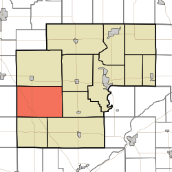
West Point Township, White County, Indiana
West Point Township | |
|---|---|
 A windmill in southwestern West Point Township | |
 Location in White County | |
| Coordinates: 40°41′26″N 87°01′02″W / 40.69056°N 87.01722°W | |
| Country | United States |
| State | Indiana |
| County | White |
| Government | |
| • Type | Indiana township |
| Area | |
• Total | 53.6 sq mi (139 km2) |
| • Land | 53.53 sq mi (138.6 km2) |
| • Water | 0.07 sq mi (0.2 km2) 0.13% |
| Elevation | 722 ft (220 m) |
| Population (2020) | |
• Total | 357 |
| • Density | 6.7/sq mi (2.6/km2) |
| ZIP codes | 47929, 47980, 47995 |
| GNIS feature ID | 454049 |
West Point Township is one of twelve townships in White County, Indiana, United States. As of the 2020 census, its population was 357 and it contained 136 housing units.[1]
West Point Township was organized in 1845, and was named for a large tract of forest in the western part.[2]
| Census | Pop. | Note | %± |
|---|---|---|---|
| 1890 | 905 | — | |
| 1900 | 960 | 6.1% | |
| 1910 | 922 | −4.0% | |
| 1920 | 875 | −5.1% | |
| 1930 | 824 | −5.8% | |
| 1940 | 746 | −9.5% | |
| 1950 | 672 | −9.9% | |
| 1960 | 689 | 2.5% | |
| 1970 | 494 | −28.3% | |
| 1980 | 430 | −13.0% | |
| 1990 | 418 | −2.8% | |
| 2000 | 371 | −11.2% | |
| 2010 | 381 | 2.7% | |
| 2020 | 357 | −6.3% | |
| Source: US Decennial Census[3] | |||
Geography
According to the 2010 census, the township has a total area of 53.6 square miles (139 km2), of which 53.53 square miles (138.6 km2) (or 99.87%) is land and 0.07 square miles (0.18 km2) (or 0.13%) is water.[4]
Adjacent townships
- Princeton Township (north)
- Honey Creek Township (northeast)
- Big Creek Township (east)
- Prairie Township (southeast)
- Round Grove Township (south)
- Pine Township, Benton County (southwest)
- Gilboa Township, Benton County (west)
Cemeteries
The township contains West Point Cemetery. Near the back of this cemetery is a marker for Alexander Lawrie, a northern captain in the Civil War and an artist of the Hudson River School. The market claims that Lawrie made a gift to the Indiana Museum of a set of 100 paintings of Civil War generals.
School districts
- Tri-County School Corporation
Political districts
- Indiana's 4th congressional district
- State House District 15
- State Senate District 07
References
- United States Census Bureau 2007 TIGER/Line Shapefiles
- United States Board on Geographic Names (GNIS)
- IndianaMap
- ^ "Explore Census Data". data.census.gov. Retrieved April 14, 2024.
- ^ Hamelle, W. H. (1915). A Standard History of White County, Indiana: An Authentic Narrative of the Past, with an Extended Survey of Modern Developments in the Progress of Town and Country. Unigraphic. p. 278.
- ^ "Township Census Counts: STATS Indiana".
- ^ "Population, Housing Units, Area, and Density: 2010 - County -- County Subdivision and Place -- 2010 Census Summary File 1". United States Census. Archived from the original on February 12, 2020. Retrieved May 10, 2013.

