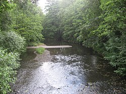
Trnava (Želivka)
| Trnava | |
|---|---|
 The Trnava in Želiv | |
 | |
| Location | |
| Country | Czech Republic |
| Regions | |
| Physical characteristics | |
| Source | |
| • location | Vodice, Křemešník Highlands |
| • elevation | 672 m (2,205 ft) |
| Mouth | |
• location | Želivka |
• coordinates | 49°21′24″N 16°24′17″E / 49.35667°N 16.40472°E |
• elevation | 393 m (1,289 ft) |
| Length | 56.3 km (35.0 mi) |
| Basin size | 340.1 km2 (131.3 sq mi) |
| Discharge | |
| • average | 2.06 m3/s (73 cu ft/s) near estuary |
| Basin features | |
| Progression | Želivka→ Sázava→ Vltava→ Elbe→ North Sea |
The Trnava is a river in the Czech Republic, a left tributary of the Želivka River. It flows through the Vysočina and South Bohemian regions. It is 56.3 km (35.0 mi) long.
Etymology
The name is derived from the Czech word trn ('thorn'), meaning "the river flowing through thorns (thorly bushes)".[1]
Characteristic

The Trnava originates in the territory of Vodice in the Křemešník Highlands at an elevation of 672 m (2,205 ft) and flows to Želiv, where it enters the Želivka River at an elevation of 393 m (1,289 ft). It is 56.3 km (35.0 mi) long. Its drainage basin has an area of 340.1 km2 (131.3 sq mi).[2]
The longest tributaries of the Trnava are:[3]
| Tributary | Length (km) | River km | Side |
|---|---|---|---|
| Kejtovský potok | 22.1 | 23.7 | right |
| Bořetický potok | 11.8 | 19.4 | right |
| Novomlýnský potok | 8.9 | 44.3 | left |
| Barborka | 8.1 | 41.1 | left |
Flow
The river flows through the municipal territories of Vodice, Dolní Hořice, Cetoraz, Pacov, Zhořec, Těchobuz, Salačova Lhota, Bratřice, Velká Chyška, Samšín, Lesná, Hořepník, Bořetice, Rovná, Arneštovice, Křelovice, Červená Řečice and Želiv.
In almost its entire length, the Trnava passes through a 100–200 m wide valley with steep, mostly wooded slopes.[4]
Bodies of water
There are 515 bodies of water in the basin area. The largest of them is the Trnávka Reservoir, built on the Trnava near its mouth.[2] It was built in 1977–1981 on an area of 98 ha (240 acres). The main purpose of the reservoir is to capture alluvium brought by the water flow into the Švihov Reservoir.[5] Several fishponds are built on the upper course of the river.
Sport

In the section between the Trnávka Reservoir and the mouth of the river to Želivka, there is the Trnávka Slalom Channel. It is considered the most difficult slalom channel in the Czech Republic. Since 2014, there has been an annual event known as the Trnava X-race, which is an extreme kayak and canoe race.[6]
See also
References
- ^ Hosák, Ladislav; Šrámek, Rudolf (1980). Místní jména na Moravě a ve Slezsku II: M–Ž (in Czech). Prague: Czechoslovak Academy of Sciences. pp. 601–602.
- ^ a b "Základní charakteristiky toku Trnava a jeho povodí" (in Czech). T. G. Masaryk Water Research Institute. Retrieved 2024-10-09.
- ^ "Vodní toky". Evidence hlásných profilů (in Czech). Czech Hydrometeorological Institute. Retrieved 2024-10-16.
- ^ "Povodňový plán obce Hořepník: Hydrologické údaje". Elektronický digitální povodňový portál (in Czech). Retrieved 2024-10-09.
- ^ "VD Trnávka" (PDF) (in Czech). Povodí Vltavy s.p. Retrieved 2024-10-09.
- ^ "Závod Trnava-X-race" (in Czech). CzechTourism. Retrieved 2024-10-09.
External links
- River flow at Červená Řečice station – Flood Warning and Forecasting Service of the Czech Hydrometeorological Institute
