The Pines, South Australia
| The Pines South Australia | |||||||||||||||
|---|---|---|---|---|---|---|---|---|---|---|---|---|---|---|---|
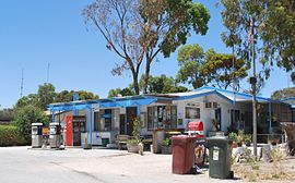
 The general store at The Pines | |||||||||||||||
| Coordinates | 34°54′50″S 137°10′01″E / 34.913860°S 137.166970°E | ||||||||||||||
| Population | 135 (SAL 2021)[2] | ||||||||||||||
| Established | 1999[1] | ||||||||||||||
| Postcode(s) | 5575[3] | ||||||||||||||
| Time zone | ACST (UTC+9:30) | ||||||||||||||
| • Summer (DST) | ACST (UTC+10:30) | ||||||||||||||
| Location | 131 km (81 mi) west of Adelaide city centre | ||||||||||||||
| LGA(s) | Yorke Peninsula Council[1] | ||||||||||||||
| State electorate(s) | Narungga[4] | ||||||||||||||
| Federal division(s) | Grey[5] | ||||||||||||||
| |||||||||||||||
| |||||||||||||||
| Footnotes | Location[3] Coordinates[1] Climate[6] Adjoining localities[7] | ||||||||||||||
The Pines is a locality in the Australian state of South Australia located on the western side of Yorke Peninsula on the portion forming the south coast of Hardwicke Bay in Spencer Gulf about 131 kilometres (81 miles) west of the Adelaide city centre.[3][7]
Its boundaries were created in May 1999 for the “long established name” which includes the Collin Beach Shack Site.[1] The name was first used in 1972 for a private sub-division developed by a James N Faggoter of land owned by him in the cadastral unit of the Hundred of Para Wurlie after received approval for the name from the Geographical Names Board in 1970.[1] A result of the creation of boundaries in 1999 was that The Pines fully enclosed the adjoining locality of Couch Beach on all sides except the coastline.[1]
As of 2015, the land use within the locality is dominated between agriculture and land zoned as “water protection” in order to protect groundwater basins present at “shallow depths” and to encourage land use such as “broadacre cropping, grazing, and wind farm and ancillary development.” A third land use is residential which concerns the land associated with the original sub-division and the former shack site both located near the coastline with Spencer Gulf. A fourth land use within the locality is conservation which concerns the strip of land immediately adjoining the coastline as well as the Leven Beach Conservation Park located in the locality's northeast corner.[8]
The Pines is located within the federal division of Grey, the state electoral district of Narungga and the local government area of the Yorke Peninsula Council.[5][4][1]
See also
References
- ^ a b c d e f g "Search result for "The Pines (Locality Bounded)" (Record no SA0055526) with the following layers being selected - "Suburbs and Localities" and "Place names (gazetteer)"". Government of South Australia. Retrieved 9 May 2016.
- ^ Australian Bureau of Statistics (28 June 2022). "The Pines (SA) (suburb and locality)". Australian Census 2021 QuickStats. Retrieved 28 June 2022.
- ^ a b c "Postcode for The Pines, South Australia". postcodes-australia.com. Retrieved 9 May 2016.
- ^ a b Narungga (Map). Electoral District Boundaries Commission. 2016. Retrieved 1 March 2018.
- ^ a b "Federal electoral division of Grey" (PDF). Australian Electoral Commission. Retrieved 24 July 2015.
- ^ "Monthly climate statistics: Summary statistics Warooka (nearest station)". Commonwealth of Australia, Bureau of Meteorology. Retrieved 9 May 2016.
- ^ a b com_docman/task, doc_download/gid,3366/Itemid,99999999/ "New Ward Structure 2014". Yorke Peninsula Council. Archived from com_docman/task, doc_download/gid,3366/Itemid,99999999/ the original on 15 January 2016. Retrieved 18 February 2016.
{{cite web}}: Check|archiveurl=value (help); Check|url=value (help) - ^ "Development Plan - Yorke Peninsula Council - Consolidated – 26 November 2015" (PDF). Department of Planning, Transport and Infrastructure. pp. 190–194, 261–263 and 397–398. Retrieved 25 February 2016.

