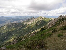
Roc de Frausa
| Roc de Fraussa | |
|---|---|
 | |
| Highest point | |
| Elevation | 1,421 m (4,662 ft) |
| Coordinates | 42°25′22″N 2°43′38″E / 42.42278°N 2.72722°E |
| Geography | |
Roc de Fraussa, erroneusly referred to as Roc de Frausa or Roc de França, is a mountain of Catalonia, Spain located in the Serra de Les Salines. It lies between the municipality of Maçanet de Cabrenys in the Alt Empordà region and the communes of Reiners and Céret in the Vallespir, France. It has an elevation of 1,421 metres above sea level.[1]
See also
References
- ^ "Mapa Topogràfic de Catalunya". Institut Cartogràfic de Catalunya. Retrieved May 22, 2010..

