Palavoor
Palavoor | |
|---|---|
Village | |
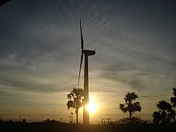
 Sunset in the southern part of the village | |
| Coordinates: 08°12′20″N 77°34′21″E / 8.20556°N 77.57250°E | |
| Country | |
| State | Tamil Nadu |
| District | Tirunelveli |
| Taluk | Radhapuram |
| Government | |
| • Type | Gram Panchayat |
| Area | |
• Total | 38.85 km2 (15.00 sq mi) |
| Elevation | 53 m (174 ft) |
| Population (2011) | |
• Total | 17,780 |
| • Density | 460/km2 (1,200/sq mi) |
| Languages | |
| • Official | Tamil |
| Time zone | UTC+5:30 (IST) |
| PIN | 627114 |
| STD code | 04637 |
| Vehicle registration | TN-72 |
Palavoor is a village in Radhapuram Taluk, Tirunelveli District, Tamil Nadu, India. It is located near the coast of the Indian Ocean, about 60 kilometres south of the district seat Tirunelveli, and 14 kilometres southwest of the taluk seat Radhapuram. In 2011, the village had a total population of 17,780.[1]
Geography
Palavoor is located on the south of Vadakupathu Kulam. The National Highway 44 passes through it. The average elevation of the village is 53 metres above the sea level.[2]
Demographics
According to the 2011 Indian Census, Palavoor has 4,611 households. Among the 17,780 residents, 8,837 are male and 8,943 are female. The overall literacy rate is 79.67%, with 7,252 of the male inhabitants and 6,914 of the female inhabitants being literate. The census location code of the village is 643085.[1]
References
- ^ a b "Basic Population Figures of India, States, Districts, Sub-District and Village, 2011". censusindia.gov.in. Archived from the original on 2 March 2023. Retrieved 16 April 2023.
- ^ "Palavoor topographic map, elevation, terrain". Topographic maps. Retrieved 16 April 2023.


