Nihonkai evergreen forests
| Nihonkai evergreen forests | |
|---|---|
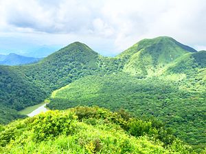
 Mt. Sanbe, near Oda | |
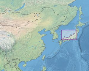
 Ecoregion territory (in purple) | |
| Ecology | |
| Realm | Palearctic |
| Biome | Temperate broadleaf and mixed forests |
| Geography | |
| Area | 21,496 km2 (8,300 sq mi) |
| Country | Japan |
| Coordinates | 35°30′N 133°00′E / 35.5°N 133°E |
The Nihonkai evergreen forests ecoregion (WWF ID: PA0427) covers a thin strip of land on the western coast (facing the Sea of Japan) of the island of Honshu in Japan. It is bounded on the east by the Nihonkai montane deciduous forests ecoregion.[1][2]
Location and description
The coastal strips extends for most of the length of the island, encompassing bays, inlets, rocky coasts and caves. Also represented in the ecoregion are the Oki Islands and Sado Island in the Sea of Japan about 40 km west of Honshu.[3]
Climate
The climate of the ecoregion is Humid continental climate, warm wet summer (Köppen climate classification (Cfa)). This climate is characterized by large seasonal temperature differentials. No month averages below 0 °C (32 °F), at least one month averages above 22 °C (72 °F), and four months average over 10 °C (50 °F). Precipitation is relatively even throughout the year.[4][5]
Flora and fauna
About 37% of the ecoregion is closed evergreen needle-leaf forest, 27% is closed deciduous forest, 11% cultivated, 10% urban/built-up, and the rest is other types of terrain.[3]
Protected areas
References
- ^ "Nihonkai evergreen forests". World Wildlife Federation. Retrieved March 21, 2020.
- ^ "Map of Ecoregions 2017". Resolve, using WWF data. Retrieved September 14, 2019.
- ^ a b "Taiheiyo montane deciduous forests". Digital Observatory for Protected Areas. Retrieved July 17, 2020.
- ^ Kottek, M.; Grieser, J.; Beck, C.; Rudolf, B.; Rubel, F. (2006). "World Map of Koppen-Geiger Climate Classification Updated" (PDF). Gebrüder Borntraeger 2006. Retrieved September 14, 2019.
- ^ "Dataset - Koppen climate classifications". World Bank. Retrieved September 14, 2019.
