N170 highway
| Route 170 | ||||
|---|---|---|---|---|
| Route information | ||||
| Maintained by Department of Public Works and Highways and Metropolitan Manila Development Authority | ||||
| Major junctions | ||||
| North end | ||||
| ||||
| South end | ||||
| Location | ||||
| Country | Philippines | |||
| Major cities | Quezon City, Manila, Pasay | |||
| Highway system | ||||
| ||||
| ||||
National Route 170 (N170) is a national secondary road of the Philippine highway network. It passes through the northern part of Metro Manila, traversing through the cities of Quezon City, Manila, and Pasay.[1]
Route description
Most of the route in the northern part follows the alignment of Radial Road 7 (R-7) of Manila's arterial road network.
Based on the designation Department of Public Works and Highways (DPWH), N170 consists of the following segments, from north to south:[2][3][4][5]
In Quezon City

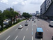
N170 commences at its intersection with N127 in Novaliches, Quezon City as Commonwealth Avenue. It is a major highway with 6 to 12 lanes and consequently it is the widest segment of the Philippines highway network.
Due to the high incidence of road accidents, most especially those involving overspeeding, it has earned its notorious nickname the "Killer Highway." A speed limit of 60 km/h (37 mph) has been enforced on the said highway to reduce the rate of accidents.
The Manila Metro Rail Transit System Line 7 (MRT-7) has been in construction since 2016, including the span of the elevated railway network at Regalado Highway. The said mass transit system, which will connect to the Manila Metro Rail Transit System (MRT) and the North Avenue Grand Central Station,[6] is expected to ease the flow of traffic along the avenue. Due to a recent delay involving the proposed location of the system's depot in San Jose del Monte, Bulacan (which has been moved to Barangay Lagro, Quezon City), the system's completion and operations will start, albeit partially, in 2021.[7][8]
Commonwealth Avenue ends in Diliman, and N170 follows the route of Elliptical Road, an 8-lane roundabout that surrounds the Quezon Memorial Circle (QMC). Named after its elliptical shape, the Elliptical Road's traffic flow is by counterclockwise direction.

After leaving Elliptical Road, the route follows Quezon Avenue, a major intra-city highway of Quezon City named after Manuel L. Quezon, the 2nd president of the Philippines. Beginning at Elliptical Road and ending at the Welcome Rotonda near the Quezon City–Manila boundary, it has 6 to 14 lanes and is one of the city's most comfortable roads, lined with palm trees that serve as its median. Many government and commercial buildings line the road.
In northern Manila

After leaving the Welcome Rotonda, N170 enters the City of Manila, the nation's capital, as España Boulevard. It is a major highway in the district of Sampaloc that is named after Spain, which ruled the Philippines for 333 years, from 1565 up to 1898. It is an arterial road with eight lanes, four per direction, that commences at Welcome Rotonda and ends at the intersection of Nicanor Reyes Street (formerly Morayta) and Lerma Streets. The Nicanor B. Reyes Street leads to Recto Avenue, while Lerma Street leads to Quezon Boulevard. The University of Santo Tomas (UST) campus lies on this segment of N170.

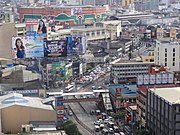
N170 follows Lerma Street, which links España Boulevard and Quezon Boulevard. After leaving Lerma Street, N170 is known as Quezon Boulevard, a notable intra-city highway that traverses the district of Quiapo from north to south. A 6-to-10-lane divided road, it links the traditional core of the nation's capital with the North Luzon Expressway in northern Metro Manila through Alfonso Mendoza (formerly Andalucia) and Dimasalang Streets. It also links the old downtown of Manila with Quezon Memorial Circle and Batasang Pambansa Complex in Quezon City through a tunnel that goes to the rest of northern N170. It also lies in an area known as the University Belt.
In southern Manila
N170 crosses above the Pasig River at Quezon Bridge, and this segment ends at the intersection with Antonio Villegas Street (formerly Arroceros) in Ermita. The route continues as the southbound Quezon Bridge—Liwasang Bonifacio segment of Padre Burgos Avenue. Past the Liwasang Bonifacio West Overpass, the route is discontinued; however, the gap is filled by N150's Liwasang Bonifacio—Taft Avenue segment.

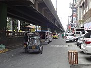
N170 resumes at the Lagusnilad vehicular underpass, and becomes Taft Avenue, the remaining segment of the route from Ermita, Manila to Pasay. It is a major highway named after the former governor-general of the Philippines and U.S. president William Howard Taft. The elevated Manila Light Rail Transit System Line 1 (LRT-1) serves as its median in its entirety. N170 ends at Taft Avenue's intersection with EDSA in Pasay. The short segment of Taft Avenue from EDSA to Harrison Avenue, known as Taft Avenue Extension and providing access to Baclaran in Parañaque, is an unnumbered national tertiary road.[5]
References
- ^ "NCR". Department of Public Works and Highways. Retrieved June 17, 2019.
- ^ "North Manila". Department of Public Works and Highways. Retrieved June 17, 2019.
- ^ "Quezon City 1st". Department of Public Works and Highways. Retrieved June 17, 2019.
- ^ "Quezon City 2nd". Department of Public Works and Highways. Retrieved June 17, 2019.
- ^ a b "South Manila". Department of Public Works and Highways. Retrieved June 17, 2019.
- ^ "Construction of the MRT Line 7 begins". Official Gazette. Government of the Republic of the Philippines. April 20, 2016.
- ^ Ces Dimalanta at Emmie Abadilla (April 20, 2016). "DOTC, SMC break ground for P69.3B MRT-7". Manila Bulletin. Retrieved April 20, 2016.
- ^ Balinbin, A.L. (November 28, 2019). "MRT-7 clears key hurdle". BusinessWorld. Retrieved November 29, 2019.

