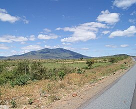
Mount Kwaraha
| Mount Kwaraha | |
|---|---|
 | |
| Highest point | |
| Elevation | 2,415 m (7,923 ft) |
| Geography | |
 | |
| Location | Manyara Region |
| Geology | |
| Mountain type | Stratovolcano[1] |
| Last eruption | Pleistocene[1] |
Mount Kwaraha is a mountain in central Tanzania. It is located approximately 5 km (3.1 mi) east of the town of Babati, in Babati District of Manyara Region.
Mount Kwaraha is a granite inselberg, and rises to 2,415 m (7,923 ft).[2] The mountain has numerous springs and streams which flow west into Lake Babati and east into the Tarangire River.
The mountain has mist forests above 1,800 m (5,900 ft) elevation, and is home to small numbers of elephants and buffalo, and large numbers of birds and monkeys.[2]
Ufiome Forest Reserve covers 54.36 km2 (20.99 sq mi) of the mountain.[3]
References
04°13′47″S 35°48′4″E / 4.22972°S 35.80111°E
