Mid Clare Way
| Mid Clare Way | |
|---|---|
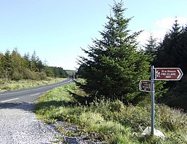
 Trail crossing R462 road | |
| Length | 148 km (92 mi)[1] |
| Location | County Clare, Ireland |
| Designation | National Waymarked Trail[1] |
| Trailheads | Newmarket-on-Fergus |
| Use | Hiking |
| Elevation gain/loss | +1,620 m (5,315 ft)[1] |
| Difficulty | Moderate[1] |
| Season | Any |
The Mid Clare Way is a long-distance trail in County Clare, Ireland. It is a 148-kilometre (92-mile) long circular route that begins and ends in Newmarket-on-Fergus. It is typically completed in six days.[1] It is designated as a National Waymarked Trail by the National Trails Office of the Irish Sports Council and is managed by East & Mid Clare Way Limited and the Mid Clare Way Committee.[2] The trail was developed over a six-year period and opened on 31 May 1999 by Síle de Valera, Minister for Arts, Heritage, Gaeltacht and the Islands.[3]
The trail makes a circuit of the countryside surrounding the town of Ennis, taking in the villages of Quin, Spancil Hill, Doon, Ruan, Connolly, Lissycasey and Clarecastle.[4] The trail connects with the East Clare Way at the townland of Gortnamearacaun.[4]
A review of the National Waymarked Trails in 2010 found the condition of the route to be poor and usage to be low with a high proportion of the route (65%) to be on roads.[5] The report recommended that format of the trail be examined and consideration given to the development of a series of shorter walks.[6]
References
Notes
- ^ a b c d e "Mid Clare Way". IrishTrails. Irish Sports Council. Retrieved 2 August 2011.
- ^ National Trails Office 2010, p. 39.
- ^ "Mid-Clare Way opens after six years of effort". The Irish Times. Dublin. 31 May 1999. p. 2.
- ^ a b "The Mid Clare Way". Clare Trails. Archived from the original on 19 April 2011. Retrieved 2 August 2011.
- ^ National Trails Office 2010, pp. 39–40.
- ^ National Trails Office 2010, p. 40.
Bibliography
- National Trails Office (2010). "Setting New Directions. A review of National Waymarked Ways in Ireland" (PDF). Dublin: Irish Sports Council. Archived from the original (pdf) on 31 May 2011. Retrieved 1 August 2011.
External links


