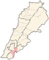
Majdal Selem
Majdal Selem مجدل سلم | |
|---|---|
Municipality | |
| Coordinates: 33°13′18″N 35°27′52″E / 33.22167°N 35.46444°E | |
| Grid position | 193/291 PAL |
| Country | |
| Governorate | Nabatieh Governorate |
| District | Marjayoun District |
| Area | |
• Total | 12.05 km2 (4.65 sq mi) |
| Elevation | 560 m (1,840 ft) |
| Time zone | UTC+2 (EET) |
| • Summer (DST) | UTC+3 (EEST) |
| Dialing code | +961 |
Majdal Selem (Arabic: مجدل سلم) is a municipality in the Marjayoun District in Southern Lebanon.
Etymology
According to E. H. Palmer, the name Mejdel Islim means Islim's watch-tower, p.n.[2]
Majdal Selem means Fortress of Peace, or Peace Fortress.
History
In 1596, it was named as a village, Majdal Salim, in the Ottoman nahiya (subdistrict) of Tibnin under the Liwa Safad, with a population of 51 households and 8 bachelors, all Muslim. The villagers paid a fixed tax-rate of 25 % on agricultural products, such as wheat, barley, olive trees, fruit trees, vegetable and fruit garden, orchard, goats, beehives, in addition to "occasional revenues" and a press for olive oil or grape syrup; a total of 9,110 akçe.[3][4]
In 1875, Victor Guérin found that the village had about 300 Metawileh inhabitants.[5] He further noted: "A mosque, now abandoned and falling into ruins, has succeeded here a Byzantine church, the materials of which have been used in building it. Over one of the windows is a stone (apparently once the lintel) with an old Greek inscription, the characters of which are too much defaced to be read. A monolithic column lies beside it, half buried in the ground, surmounted by a capital sculptured in form of open basket work."[6]
In 1881, the PEF's Survey of Western Palestine (SWP) described it as a "large village, built of stone, of ancient appearance, containing about 500 [..] Metawileh [..]. Situated on table land, surrounded by olives and arable land. Water supply from a large masonry birket and many cisterns."[7] They further noted: "Village containing several good lintels and remains of ruins; an ancient road leads from the village to the Birkeh."[8]
On 15 February 1993, the village was attacked by Israeli helicopter gunships following an attack on SLA positions earlier in the day.[9] During the 1996 Israeli seventeen day bombardment of south Lebanon the Nepalese UNIFIL position in Majdal Selem was hit by eight shells and extensively damaged.[10]
On 5 December 1997, three civilians were killed by a roadside bomb. The bomb was believed to have been planted by an Israeli commando special unit. Including this event forty-three civilians had been killed in southern Lebanon in 1997.[11]
On 8 January 2024, Israeli forces killed Wissam al-Tawil, the deputy commander of Hezbollah's Redwan Force, in an airstrike against his vehicle in Majdal Selem.[12]
Demographics
In 2014 Muslims made up 99.61% of registered voters in Majdal Selem. 98.37% of the voters were Shiite Muslims. [13]
References
- ^ a b Majdel Selm, Localiban
- ^ Palmer, 1881, p. 29
- ^ Hütteroth and Abdulfattah, 1977, p. 181
- ^ Note that Rhode, 1979, p. 6 Archived 2016-10-10 at the Wayback Machine writes that the register that Hütteroth and Abdulfattah studied was not from 1595/6, but from 1548/9
- ^ Guérin, 1880, p. 267
- ^ Guérin, 1880, pp. 267-268; as given in Conder and Kitchener, 1881, SWP I, pp. 136
- ^ Conder and Kitchener, 1881, SWP I, p. 89
- ^ Conder and Kitchener, 1881, SWP I, p. 136
- ^ Middle East International No 445, 5 March 1993, Publishers Lord Mayhew, Dennis Walters MP; February chronology p.15
- ^ Middle East International No 532, 16 August 1996; Michael Jansen p.20
- ^ Middle East International No 565, 19 December 1997; Michael Jansen pp.7&9
- ^ "Israeli strike kills a Hezbollah commander in Lebanon". Reuters. 8 January 2024.
- ^ https://lub-anan.com/المحافظات/النبطية/مرجعيون/مجدل-سلم/المذاهب/
Bibliography
- Conder, C.R.; Kitchener, H.H. (1881). The Survey of Western Palestine: Memoirs of the Topography, Orography, Hydrography, and Archaeology. Vol. 1. London: Committee of the Palestine Exploration Fund.
- Guérin, V. (1880). Description Géographique Historique et Archéologique de la Palestine (in French). Vol. 3: Galilee, pt. 2. Paris: L'Imprimerie Nationale.
- Hütteroth, W.-D.; Abdulfattah, K. (1977). Historical Geography of Palestine, Transjordan and Southern Syria in the Late 16th Century. Erlanger Geographische Arbeiten, Sonderband 5. Erlangen, Germany: Vorstand der Fränkischen Geographischen Gesellschaft. ISBN 3-920405-41-2.
- Palmer, E.H. (1881). The Survey of Western Palestine: Arabic and English Name Lists Collected During the Survey by Lieutenants Conder and Kitchener, R. E. Transliterated and Explained by E.H. Palmer. Committee of the Palestine Exploration Fund.
- Rhode, H. (1979). Administration and Population of the Sancak of Safed in the Sixteenth Century. Columbia University. Archived from the original on 2016-10-10. Retrieved 2017-12-05.
External links
- Majdal Selem, MajdalSelem.org
- Majdel Selm, Localiban
- Survey of Western Palestine, Map 2: IAA, Wikimedia commons


