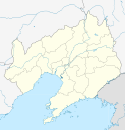
Liaoyang County
Liaoyang 辽阳县 | |
|---|---|
 Location in Liaoyang | |
| Coordinates: 41°12′N 123°06′E / 41.200°N 123.100°E | |
| Country | People's Republic of China |
| Province | Liaoning |
| Prefecture-level city | Liaoyang |
| Area | |
• Total | 2,443 km2 (943 sq mi) |
| Elevation | 75 m (247 ft) |
| Population (2020 census[1]) | |
• Total | 372,131 |
| • Density | 150/km2 (390/sq mi) |
| Time zone | UTC+8 (China Standard) |
Liaoyang County (simplified Chinese: 辽阳县; traditional Chinese: 遼陽縣; pinyin: Liáoyáng Xiàn) is a county in east-central Liaoning province in Northeast China. It is under the administration of Liaoyang City, located in between the urban area of Liaoyang City and Anshan City.
Administrative divisions
There are 14 towns, one township, and three townships in the county.[2]
Towns:
- Shoushan (首山镇), Mujia (穆家镇), Lanjia (兰家镇), Liuhao (柳壕镇), Xiaotun (小屯镇), Shaling (沙岭镇), Bahui (八会镇), Tangmazhai (唐马寨镇), Hanling (寒岭镇), Helan (河栏镇), Xiaobeihe (小北河镇), Liu'erbao (刘二堡镇), Huangniwa (黄泥洼镇), Longchang (隆昌镇)
Townships:
- Xiadahe Township (下达河乡), Tianshui Manchu Ethnic Township (甜水满族乡), Jidongyu Manchu Ethnic Township (吉洞峪满族乡)
Climate
| Climate data for Liaoyang County (1991–2020 normals) | |||||||||||||
|---|---|---|---|---|---|---|---|---|---|---|---|---|---|
| Month | Jan | Feb | Mar | Apr | May | Jun | Jul | Aug | Sep | Oct | Nov | Dec | Year |
| Mean daily maximum °C (°F) | −3.6 (25.5) |
1.0 (33.8) |
8.2 (46.8) |
17.5 (63.5) |
24.3 (75.7) |
27.9 (82.2) |
29.8 (85.6) |
29.0 (84.2) |
24.9 (76.8) |
17.1 (62.8) |
6.9 (44.4) |
−1.1 (30.0) |
15.2 (59.3) |
| Daily mean °C (°F) | −9.3 (15.3) |
−4.5 (23.9) |
2.8 (37.0) |
11.7 (53.1) |
18.5 (65.3) |
22.8 (73.0) |
25.4 (77.7) |
24.3 (75.7) |
18.8 (65.8) |
11.1 (52.0) |
1.7 (35.1) |
−6.4 (20.5) |
9.7 (49.5) |
| Mean daily minimum °C (°F) | −14.3 (6.3) |
−9.6 (14.7) |
−2.3 (27.9) |
5.8 (42.4) |
12.8 (55.0) |
17.8 (64.0) |
21.2 (70.2) |
20 (68) |
13.4 (56.1) |
5.6 (42.1) |
−3.1 (26.4) |
−11.1 (12.0) |
4.7 (40.4) |
| Average precipitation mm (inches) | 5.7 (0.22) |
7.8 (0.31) |
14.2 (0.56) |
34.3 (1.35) |
61.7 (2.43) |
93.5 (3.68) |
158.1 (6.22) |
181.7 (7.15) |
57.8 (2.28) |
44.4 (1.75) |
25.2 (0.99) |
9.9 (0.39) |
694.3 (27.33) |
| Average precipitation days (≥ 0.1 mm) | 3.1 | 3.2 | 4.2 | 6.7 | 9.2 | 11.1 | 12.0 | 11.1 | 7.2 | 6.6 | 5.6 | 3.8 | 83.8 |
| Average snowy days | 4.4 | 3.9 | 3.8 | 0.8 | 0 | 0 | 0 | 0 | 0 | 0.3 | 3.9 | 4.9 | 22 |
| Average relative humidity (%) | 60 | 55 | 51 | 48 | 52 | 64 | 75 | 77 | 69 | 63 | 61 | 62 | 61 |
| Mean monthly sunshine hours | 193.2 | 195.7 | 231.1 | 229.9 | 261.3 | 224.6 | 187.5 | 205.4 | 232.0 | 210.9 | 176.5 | 177.4 | 2,525.5 |
| Percent possible sunshine | 65 | 65 | 62 | 57 | 58 | 50 | 41 | 49 | 63 | 62 | 60 | 62 | 58 |
| Source: China Meteorological Administration[3][4] | |||||||||||||
References
- ^ "China: Liáoníng (Prefectures, Cities, Districts and Counties) – Population Statistics, Charts and Map".
- ^ 辽阳市-行政区划网
- ^ 中国气象数据网 – WeatherBk Data (in Simplified Chinese). China Meteorological Administration. Retrieved 5 October 2023.
- ^ 中国气象数据网 (in Simplified Chinese). China Meteorological Administration. Retrieved 5 October 2023.
External links

