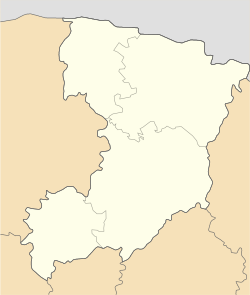
Kostopil urban hromada
Kostopil urban hromada Костопільська міська громада | |
|---|---|
| Coordinates: 50°52′59″N 26°26′46″E / 50.88306°N 26.44611°E | |
| Country | |
| Oblast (province) | |
| Raion (district) | Rivne Raion |
| Administrative center | Kostopil |
| Area | |
• Total | 653.4 km2 (252.3 sq mi) |
| Elevation | 182 m (597 ft) |
| Population (2022) | |
• Total | 44,042 |
| • Density | 67/km2 (170/sq mi) |
Kostopil urban territorial hromada (Ukrainian: Костопільська міська територіальна громада, romanized: Kostopilska miska terytorialna hromada) is a hromada located in the Rivne Oblast of western Ukraine. Its seat of government is the city of Kostopil. The hromada currently covers an area of 653.4 square kilometers, and has a total population of 44,042 (2022 est.)[1]
Climate
Kostopil urban hromada has a humid continental warm summer climate (Dfb). It sees the least rainfall in February, with an average precipitation of 42 mm; and the most in July, with 107 mm of average rainfall.
| Climate data for Kostopil | |||||||||||||
|---|---|---|---|---|---|---|---|---|---|---|---|---|---|
| Month | Jan | Feb | Mar | Apr | May | Jun | Jul | Aug | Sep | Oct | Nov | Dec | Year |
| Mean daily maximum °C (°F) | −1.2 (29.8) |
0.4 (32.7) |
6.1 (43.0) |
13.9 (57.0) |
19.4 (66.9) |
22.5 (72.5) |
24.4 (75.9) |
23.8 (74.8) |
18.5 (65.3) |
12 (54) |
6.1 (43.0) |
1 (34) |
12.2 (54.1) |
| Daily mean °C (°F) | −3.3 (26.1) |
−2.3 (27.9) |
2.1 (35.8) |
9.1 (48.4) |
14.7 (58.5) |
18.3 (64.9) |
20.1 (68.2) |
19.4 (66.9) |
14.4 (57.9) |
8.5 (47.3) |
3.8 (38.8) |
−0.9 (30.4) |
8.7 (47.6) |
| Mean daily minimum °C (°F) | −5.7 (21.7) |
−5.2 (22.6) |
−1.9 (28.6) |
3.9 (39.0) |
9.4 (48.9) |
13.3 (55.9) |
15.4 (59.7) |
14.7 (58.5) |
10.3 (50.5) |
5.2 (41.4) |
1.5 (34.7) |
−3 (27) |
4.8 (40.7) |
| Average rainfall mm (inches) | 45 (1.8) |
42 (1.7) |
49 (1.9) |
53 (2.1) |
72 (2.8) |
83 (3.3) |
107 (4.2) |
70 (2.8) |
66 (2.6) |
49 (1.9) |
50 (2.0) |
49 (1.9) |
735 (29) |
| Source: Climate-Data.org[2] | |||||||||||||
Settlements
The hromada comprises one city, Kostopil, and the following 29 villages:[1]
- Bryushkiv
- Huta
- Komarivka
- Korchivia
- Kosmachiv
- Ledne
- Maidan
- Maly Mydsk
- Maly Stydyn
- Marianivka
- Mokvynski Khutory
- Oleksandrivka
- Osova
- Penkiv
- Pidluzhne
- Piskiv
- Rokytne
- Rudnia
- Trostianets
- Trubytsi
- Velyka Liubasha
- Velykyi Mydsk
- Velykyi Stydyn
- Volytsia
- Yapolot
- Yasnobir
- Zbuzh
- Zhalyn
- Zolotolyn
History
Since 1939, this region had been a part of Kostopil Raion. On 12 June 2020, the government of Ukraine approved Decree No. 722-r, which reformed the administrative divisions of Rivne Oblast. Under this decree, Kostopil Raion was merged into Rivne Raion, and its territory was divided into two territorial hromadas: Holovyn and Kostopil.[3]
See also
References
- ^ a b Автор. "Децентралізація в Україні". decentralization.gov.ua (in Ukrainian). Retrieved 2023-03-20.
- ^ "Kostopil climate: Temperature Kostopil & Weather By Month - Climate-Data.org". en.climate-data.org. Retrieved 2023-03-20.
- ^ Kitsoft. "Кабінет Міністрів України - Про визначення адміністративних центрів та затвердження територій територіальних громад Рівненської області". www.kmu.gov.ua (in Ukrainian). Retrieved 2023-03-20.


