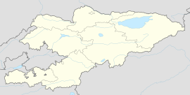
Komintern, Kyrgyzstan
Komintern Коминтерн | |
|---|---|
| Coordinates: 41°02′30″N 72°35′10″E / 41.04167°N 72.58611°E | |
| Country | |
| Region | Jalal-Abad |
| District | Nooken |
| Elevation | 604 m (1,982 ft) |
| Population (2021) | |
• Total | 4,498 |
| Time zone | UTC+6 |
Komintern (Kyrgyz: Коминтерн, formerly Nooken[1] or Naukent) is a village in Jalal-Abad Region of Kyrgyzstan. It is part of Nooken District.[2] Its population was 4,498 in 2021.[3] It lies along the M41 highway (Bishkek–Osh), between Masy and Kochkor-Ata. It lies about 9 km from the Uzbek border, about 40 kilometres (25 mi) northeast of Andijon, Uzbekistan. It was part of Fergana Oblast in the Russian Empire.[4][5] Historically it had a citadel due to its strategical location, which was taken by Shahbaz.[6]
References
- ^ "Ноокен району" [Nooken District] (PDF). Кыргызстандын Географиясы [Geography of Kyrgyzstan] (in Kyrgyz). Bishkek. 2004. p. 483.
{{cite encyclopedia}}: CS1 maint: location missing publisher (link) - ^ "Classification system of territorial units of the Kyrgyz Republic" (in Kyrgyz). National Statistics Committee of the Kyrgyz Republic. May 2021. pp. 22–23.
- ^ "Population of regions, districts, towns, urban-type settlements, rural communities and villages of Kyrgyz Republic" (XLS) (in Russian). National Statistics Committee of the Kyrgyz Republic. 2021. Archived from the original on 10 November 2021.
- ^ Prokhorov, Aleksandr Mikhaĭlovich (1982). Great Soviet encyclopedia. Macmillan. p. 246. Retrieved 11 July 2011.
- ^ Institut zur Erforschung der UdSSR. (1968). Prominent personalities in the USSR. Scarecrow Press. p. 425. Retrieved 11 July 2011.
- ^ Babur (Emperor of Hindustan); Wheeler McIntosh Thackston (11 January 1996). The Baburnama: memoirs of Babur, prince and emperor. Freer Gallery of Art. ISBN 978-0-19-509671-2. Retrieved 11 July 2011.

