Ironton, Arkansas
Ironton, Arkansas | |
|---|---|
 | |
| Coordinates: 34°37′55″N 92°16′39″W / 34.63194°N 92.27750°W | |
| Country | United States |
| State | Arkansas |
| Elevation | 328 ft (100 m) |
| GNIS feature ID | 50524[1] |
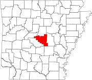
Ironton is a small unincorporated community in Pulaski County, Arkansas, United States, to the west of Wrightsville, and near Landmark. Namesakes include Ironton Baptist Church, Ironton Road, and Ironton cut-off. There are a few businesses in Ironton, and a fishing area.
The area is in the Pulaski County Special School District.[2][3]
References
- ^ a b U.S. Geological Survey Geographic Names Information System: Ironton, Arkansas
- ^ Take: "SCHOOL DISTRICT REFERENCE MAP (2010 CENSUS): Pulaski County, AR." U.S. Census Bureau. Retrieved on May 27, 2018. and compare to: "PULASKI COUNTY SPECIAL SCHOOL DISTRICT ELECTION ZONES AND SCHOOLS" (PDF). Pulaski County Special School District. Retrieved February 28, 2021. which shows which areas were taken by the Jacksonville North Pulaski School District.
- ^ "General Highway Map Pulaski County, Arkansas" (PDF). Arkansas Department of Transportation. Archived from the original (PDF) on July 7, 2011. Retrieved February 28, 2021. - See Ironton on the map.

