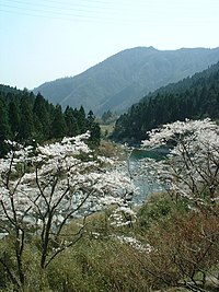
Ichi River
| Ichi River | |
|---|---|
 | |
 | |
| Native name | 市川 (Japanese) |
| Location | |
| Country | Japan |
| Physical characteristics | |
| Source | |
| • elevation | 855 m |
| Mouth | Harima Sea |
• coordinates | 34°46′27″N 134°40′27″E / 34.7743°N 134.6742°E |
| Length | 73 km |
| Basin size | 496 km2 |
| Basin features | |
| Classification | Class B river |
The Ichi River (市川, Ichi-kawa) is a river which flows through the southwest of Hyōgo Prefecture, Japan.[1] The Ibo, Kako, Ichi, Yumesaki, and Chikusa rivers are collectively referred to as the Harima Gokawa, the five major rivers that flow into the Harima Sea.
Geography
The Ichi River originates from Mount Mikuni (855m above sea level) in Ikuno, Asago City, near the border of the Tanba and Harima districts in central Hyōgo Prefecture, and flows southwards through the Kanzaki District and Himeji City, emptying into the Harima Sea at Himeji City.
References
- ^ "江戸・明治期の堰や突堤に治水効果 最新技術で検証 兵庫・姫路 | 防災・危機管理トピックス | リスク対策.com | 新建新聞社". リスク対策.com. Retrieved 2021-09-21.
