County of Grey
| Grey South Australia | |||||||||||||||
|---|---|---|---|---|---|---|---|---|---|---|---|---|---|---|---|
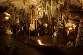
 Dolomite formations in Tantanoola Caves within the Hundred of Hindmarsh | |||||||||||||||
| Coordinates | 37°39′S 140°38′E / 37.65°S 140.64°E | ||||||||||||||
| Established | 23 July 1846[1] | ||||||||||||||
| Area | 5,294 km2 (2,044.0 sq mi) | ||||||||||||||
| LGA(s) | |||||||||||||||
| |||||||||||||||
The County of Grey is one of the 49 cadastral counties of South Australia. It was proclaimed in 1846 by Governor Frederick Robe and named for former Governor George Grey.[2] It covers the extreme south-east of the state from Penola and Lake George southwards.[2] This includes the following contemporary local government areas of the state:
Hundreds
The County of Grey is divided into the following 21 hundreds:
- Hundred of Lake George (Lake George)
- Hundred of Symon (Thornlea)
- Hundred of Kennion (Furner)
- Hundred of Short (Wattle Range)
- Hundred of Monbulla (Monbulla)
- Hundred of Penola (Penola)
- Hundred of Rivoli Bay (Beachport)
- Hundred of Mount Muirhead (Millicent)
- Hundred of Riddoch (Mount McIntyre)
- Hundred of Grey (Kalangadoo)
- Hundred of Nangwarry (Nangwarry)
- Hundred of Mayurra (Canunda)
- Hundred of Hindmarsh (Tantanoola)
- Hundred of Young (Dismal Swamp)
- Hundred of Mingbool (Mingbool)
- Hundred of Benara (German Creek)
- Hundred of Blanche (Mount Gambier, Compton)
- Hundred of Gambier (Glenburnie)
- Hundred of Kongorong (Kongorong)
- Hundred of MacDonnell (Allendale East)
- Hundred of Caroline (Caroline)
References
- ^ Mundy, A. M. (23 July 1846). "PROCLAMATION (re Counties of the Province of South Australia)" (PDF). South Australian Government Gazette. South Australian Government. p. 237. Retrieved 25 February 2018.
- ^ a b "Search for 'County of Grey, CNTY' (ID SA0028105)". Government of South Australia. Archived from the original on 7 December 2015. Retrieved 16 February 2016.
Other Details: Area 2044 square miles. George Grey, Governor of South Australia 15/5/1841-25/10/1845. Supporting Information: Government Gazette 23/7/1846

