Huanglong Scenic and Historic Interest Area
| UNESCO World Heritage Site | |
|---|---|
 | |
| Location | Songpan County, Sichuan, People's Republic of China |
| Criteria | Natural: (vii) |
| Reference | 638 |
| Inscription | 1992 (16th Session) |
| Area | 60,000 ha (230 sq mi) |
| Coordinates | 32°44′36″N 103°49′59″E / 32.7432°N 103.8330°E |
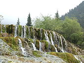
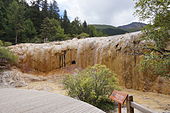
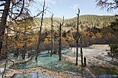
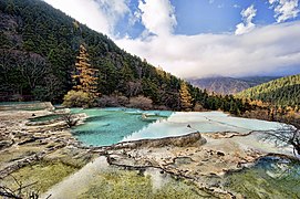
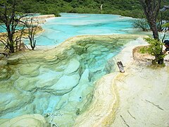
Huanglong (simplified Chinese: 黄龙; traditional Chinese: 黃龍; pinyin: Huánglóng; lit. 'yellow dragon') is a scenic and historic interest area in the northwest part of Sichuan, China. It is located in the southern part of the Minshan mountain range, 370 kilometres (230 mi) north-northwest of the capital Chengdu.[1] This area is known for its colorful travertine pools formed by calcite deposits, especially in Huanglonggou (Yellow Dragon Gully), as well as diverse forest ecosystems, snow-capped peaks, waterfalls and hot springs. Huanglong is also home to many endangered species including the giant panda and the Sichuan golden snub-nosed monkey.[1] In addition, a large population of the endemic orchid species 'Cypripedium plectrochilum' was discovered at the site[2] Huanglong was declared a World Heritage Site by UNESCO in 1992 because of its outstanding travertine formations, waterfalls and limestone formations as well as its travertine terraces and lakes rating among the three most outstanding examples in the world.[1][3]
Description
 Repeated glaciation events, the unique terrane structure, the formation of tufa, the stratum of carbonic acid rock, and climatic conditions such as Arctic-alpine sunlight have created this world-famous travertine landscape. Huanglong covers an area of 700 km2 at an altitude between 1700m and 5588m. Major scenic areas include:
- Huanglong Valley (黄龙沟)
- Danyun Gorge (Chinese: 丹云峽; lit. 'red cloud gorge'): A canyon more than 1,000 meters in depth. The snow melt from the nearby Mount Xuebaoding travels through this canyon, providing much of the water for the region.[4]
- Muni Valley (牟尼沟)
- Xuebaoding (雪宝顶; 'snow treasure peak') – 5,588 m (18,333 ft). The highest peak in the Min Mountains
- Xueshan Ridge (雪山梁; 'snow mountain ridge') – 4,007 m (13,146 ft), the highest point on the road from Jiuhuang Airport to Huanglong Valley.
- Red Star Rock (红星岩)
- Sigou (四沟; 'fourth gully')
Huanglong Valley
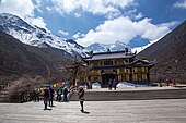
The total length of the travertine in Huanglong Valley is 3.6 km and it is thought to look like a huge golden dragon wheeling through the snow-capped mountains of the valley. The main landscapes are travertine banks, colorful ponds and travertine waterfalls and caves. The main body of water starts from the ancient Buddhist/Benbo temple at the top of the valley and ends at the Guests Welcome Pond in the north with a length of 2.5 km and a width of 30–170m. The colours of Huanglong's waters consist of yellows, greens, blues and browns.


Gallery
See also
- Baishuitai, Yunnan, China
- Badab-e Surt in Iran
- Mammoth Hot Springs in Yellowstone Park, United States
- Band-e Amir in Afghanistan
- Semuc Champey in Guatemala
- Plitvice Lakes in Croatia
- Pamukkale in Turkey
- Travertine
References
- ^ a b c "Huanglong Scenic and Historic Interest Area".
- ^ Li, P.; Luo, Y.; Bernhardt, P.; Kou, Y.; Perner, H. (27 February 2008). "Pollination of Cypripedium plectrochilum (Orchidaceae) by Lasioglossum spp. (Halictidae): the roles of generalist attractants versus restrictive floral architecture". Plant Biology. 10 (2): 220–230. doi:10.1111/j.1438-8677.2007.00020.x. PMID 18304196.
- ^ "Huanglong Scenic and Historic Interest Area". UNESCO World Heritage Centre. Retrieved 2021-04-22.
- ^ Huadong, Guo (2013). Atlas of Remote Sensing for World Heritage: China. Springer. pp. 282–287. ISBN 978-3-642-32823-7.
External links


