Henry Knox Trail

The Henry Knox Trail, also known as the Knox Cannon Trail, is a network of roads and paths that traces the route of Colonel Henry Knox's "noble train of artillery" from Crown Point to the Continental Army camp outside Boston, Massachusetts early in the American Revolutionary War.
History
Knox was commissioned by Continental Army commander George Washington in 1775 to transport 59 cannons from captured forts on Lake Champlain, 30 from Fort Ticonderoga and 29 from Crown Point, to the army camp outside Boston to aid the war effort there against British forces.[1] They included forty-three heavy brass and iron cannons, six cohorns, eight mortars, and two howitzers.[2] Knox, using sledges pulled by teams of oxen to haul these cannons, many weighing over a ton, crossed an icy Lake George in mid-winter.[2] He proceeded to travel through rural New York and the snow-covered Berkshire Mountains of Massachusetts, finally arriving to the aid of the beleaguered Continental Army in January 1776.[2]
Marker placement
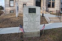
In 1926, the 150th anniversary of Knox's march, the states of New York and Massachusetts both began installing commemorative plaques at 56 locations in the two states that trace the route the expedition passed through.[3] The exact nature of the collaboration between the two states is unclear, however the work was completed in 1927.[3] The New York markers' bronze reliefs were designed by Henry James Albright, and the Massachusetts reliefs by Henry L. Norton.
In 1975, the marker locations between Kinderhook, New York, and Alford, Massachusetts, were updated after new research, confirming theories originally advanced by North Egremont, Massachusetts, postmaster Joseph Elliott, found Knox did not pass through Claverack, New York.[4] A new marker was added to the trail at Roxbury Heritage State Park in Boston in 2009, adjacent to a house owned by General John Thomas, who guided the weapons received from Knox to their final placement on Dorchester Heights overlooking Boston.[5]
Table of Knox Trail Markers
| Marker # | Year installed | Title | Address | Picture |
|---|---|---|---|---|
| NY-0 | Crown Point | 21 Grandview Dr, Crown Point, NY 12928 | https://www.hmdb.org/PhotoFullSize.asp?PhotoID=555508 | |
| NY-1 | Fort Ticonderoga | 102 Fort Ti Rd, Ticonderoga, NY 12883 | ||
| NY-2 | Fort Ticonderoga | 102 Fort Ti Rd, Ticonderoga, NY 12883 | ||
| NY-3 | Fort Ticonderoga Portage Road | 137 Montcalm St, Ticonderoga, NY 12883 | ||
| Lake George | 651 Black Point Rd, Ticonderoga, NY 12883 | |||
| Sabbath Day Point | 44 Sabbath Day Point Rd, Silver Bay, NY 12874 | |||
| NY-6 | Bolton Landing | 19 Rogers Memorial Park Rd, Bolton Landing, NY 12814 | ||
| NY-7 | Lake George Battlefield | 75 Fort George Rd, Lake George, NY 12845 (43°25'04.4"N, 73°42'25.9"W) | ||
| NY-8 | Bloody Brook | 1716 State Route 9, Lake George, NY 12845 | ||
| NY-9 | Glens Falls | 626 Glen St, Queensbury, NY 12804 | 
| |
| NY-10 | Hudson Falls | 220 Main St, Hudson Falls, NY 12839 | 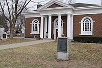
| |
| NY-11 | Fort Edward | 219 Broadway, Fort Edward, NY 12828 | 
| |
| NY-12 | Fort Miller | 1061 State Route 4, Greenwich, NY 12834 | 
| |
| NY-13 | Northumberland | 107 Starks Knob Rd, Schuylerville, NY 12871 | 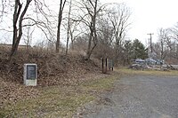
| |
| NY-14 | Schuylerville | 2 Broad St, Schuylerville, NY 12871 | 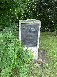
| |
| Ensign House | 513 Saratoga County Veterans Memorial Highway, Stillwater, NY 12170 | |||
| NY-15 | Bemis Heights | 1173 Old Route 32, Stillwater, NY 12170 | 
| |
| NY-16 | Stillwater | 75 Hudson Ave, Stillwater, NY 12170 | 
| |
| NY-17 | Mechanicville | 6 S Main St, Mechanicville, NY 12118 | 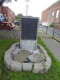
| |
| NY-18 | Waterford | 55 1st St, Waterford, NY 12188 | 
| |
| NY-19 | Klaus' Ferry | 1258 New Loudon Rd, Cohoes, NY 12047 | 
| |
| NY-20 | Latham | 206 Old Loudon Rd, Latham, NY 12110 | 
| |
| NY-21 | Albany | 350 Northern Blvd, Albany, NY 12204 | ||
| NY-22 | Albany Riverside Park | 191 Broadway, Albany, NY 12202 | ||
| NY-23 | Rensselaer | 30 Aiken Ave, Rensselaer, NY 12144 | 
| |
| NY-24 | East Greenbush | 688 Columbia Tpke, East Greenbush, NY 12061 | 
| |
| NY-25 | Schodack | 1972 Route 9, Castleton on Hudson, NY 12033 | 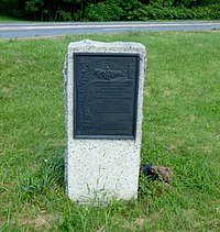
| |
| NY-26 | Kinderhook | 1 Hudson St, Kinderhook, NY 12106 | ||
| NY-27 | West Ghent | 6 Snyder Rd, Ghent, NY 12075 | 
| |
| NY-28 | Claverack | 1202 Harlemville Rd, Ghent, NY 12075 | 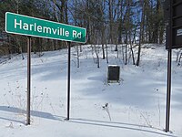
| |
| NY-29 | Old Nobletown | 40 Nobletown Rd, Hillsdale, NY 12529 | 
| |
| NY-30 / MA-1 | Alford, MA | MA-71
179 Green River Valley Rd.[6] |

| |
| MA-2 | North Egremont, MA | 223 Egremont Plain Rd. | 
| |
| MA-3 | Great Barrington, MA | Intersection of Route 23 and Route 7 | 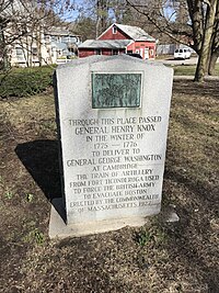
| |
| MA-4 | Monterey, MA | Route 23 | 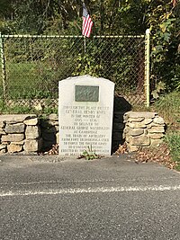
| |
| Otis, MA | Route 23 | 
| ||
| MA-5 | Blandford, MA | Route 23 & North Blandford Rd., Blandford, MA 01008 | 
| |
| MA-6 | Russell, MA | Intersection of General Knox Road and South Quarter Road | 
| |
| MA-7 | Westfield, MA | Main Street at N 42° 07.252; W 072° 44.892 | 
| |
| MA-8 | West Springfield, MA | Route 20 [7] | 
| |
| MA-9 | Springfield, MA | Boston Post Rd. (State Street) | 
| |
| MA-10 | Wilbraham, MA | Route 20 & Main Street | 
| |
| MA-11 | Palmer, MA | 1 Wilbraham Street | 
| |
| MA-12 | Warren, MA | Route 67 (Main St.) at the intersection with Washington St. | 
| |
| MA-13 | Brookfield, MA | State Route 9 at the intersection with State Route 148 | 
| |
| MA-14 | Spencer, MA | next to 117 Main St.[8] | 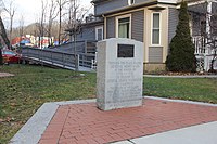
| |
| MA-15 | Leicester, MA | 1136 Main St., in front of the Leicester Public Library and Museum | ||
| MA-16 | Worcester, MA | Main Street at Lincoln Square | ||
| MA-17 | Shrewsbury, MA | Main St. at Shrewsbury Common | 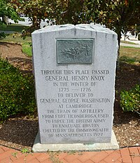
| |
| MA-18 | Northborough, MA | 63 Main Street (in front of Town Hall) | ||
| MA-19 | Marlborough, MA | |||
| MA-20 | Southborough | |||
| MA-21 | Framingham, MA | 
| ||
| MA-23 | Wayland, MA | Old Connecticut Path and Cochituate Rd. | 
| |
| MA-24 | Weston, MA | Boston Post Rd. and Town House Rd. | 
| |
| MA-25 | Waltham, MA | Route 20 (Weston St.) & Main Street | 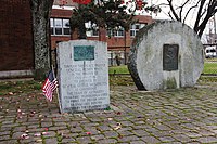
| |
| MA-26 | Watertown | 481 Mt Auburn St, Watertown, MA 02472 |  | |
| MA-27 | Cambridge | 42° 22.593′ N, 71° 7.313′ W,
Corner of Garden St and Mason St in the Cambridge Commons, Cambridge, MA[9] |
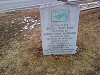
| |
| MA-27.5 | Roxbury, MA | 
| ||
| MA-28 | South Boston |
Photo gallery
- Otis-Knox Trail Stone[10]
- General Henry Knox Trail (Palmer, Massachusetts)[11]
- General Henry Knox Trail (Warren, Massachusetts)[12]
- General Henry Knox Trail (Northborough, Massachusetts)[13]
- General Henry Knox Trail (Marlborough, Massachusetts)[14]
- General Henry Knox Trail (Framingham, Massachusetts)[15]
- General Henry Knox Trail (Framingham/Wayland border, Massachusetts)[16]
- General Henry Knox Trail (Wayland, Massachusetts)[17]
- General Henry Knox Trail (Weston, Massachusetts)[18]
- General Henry Knox Trail and George Washington Memorial Highway (Waltham, Massachusetts)[19]
- General Henry Knox Trail (Cambridge, Massachusetts)[20]
References
- ^ "New York State Education Department: The Knox Trail - Introduction". Archived from the original on 2010-01-07.
- ^ a b c "New York State Education Department: The Knox Trail - History". Archived from the original on 2008-05-12.
- ^ a b "The Knox Trail – Monument Design". Archived from the original on 2009-12-11.
- ^ "New York State Education Department: Knox Trail map". Archived from the original on 2012-08-05.
- ^ "The Knox Museum joins Evacuation Day celebration" (PDF). General Henry Knox Museum. Spring 2009. Archived from the original (PDF) on 26 July 2011. Retrieved 15 December 2009.
- ^ "Knox Trail Marker - Alford, MA - U.S. Revolutionary War Memorials on". Waymarking.com. 2013-08-22. Retrieved 2022-05-04.
- ^ The site is where General Reidesel and his Hessian Soldiers encamped on October 30 and 31, 1777 on their way to Boston after British General John Burgoyne's surrender at Saratoga.
- ^ This location is close to a marker indicating that "Washington Slept Here"
- ^ "Gen. Henry Knox Trail Historical Marker".
- ^ "Knox Trail Monument No. 5 (Massachusetts)". Archived from the original on 2012-07-04. Retrieved 2013-05-09.
- ^ "Knox Trail Monument No. 11 (Massachusetts)". Archived from the original on 2012-07-04. Retrieved 2013-05-09.
- ^ "Knox Trail Monument No. 12 (Massachusetts)". Archived from the original on 2012-08-29. Retrieved 2013-05-09.
- ^ "Knox Trail Monument No. 18 (Massachusetts)". Archived from the original on 2012-07-04. Retrieved 2013-05-09.
- ^ "Knox Trail Monument No. 19 (Massachusetts)". Archived from the original on 2012-07-04. Retrieved 2013-05-09.
- ^ Knox Trail Monument No. 21 (Massachusetts) Archived 2010-01-05 at the Wayback Machine
- ^ "Knox Trail Monument No. 22 (Massachusetts)". Archived from the original on 2012-09-18. Retrieved 2013-05-28.
- ^ "Knox Trail Monument No. 23 (Massachusetts)". Archived from the original on 2012-07-04. Retrieved 2013-05-28.
- ^ "Knox Trail Monument No. 24 (Massachusetts)". Archived from the original on 2012-07-04. Retrieved 2013-05-30.
- ^ Knox Trail Monument No. 25 (Massachusetts) Archived 2012-07-04 at the Wayback Machine
- ^ "Knox Trail Monument No. 27 (Massachusetts)". Archived from the original on 2012-01-11. Retrieved 2013-05-30.
External links
- Knox Trail monuments (Flickr set) – As of 13 May 2010 includes photos of the fifteen markers from Rensselaer to Westfield.




![Otis-Knox Trail Stone[10]](https://upload.wikimedia.org/wikipedia/commons/thumb/1/16/Otis-Knox_Trail_Stone.JPG/107px-Otis-Knox_Trail_Stone.JPG)
![General Henry Knox Trail (Palmer, Massachusetts)[11]](https://upload.wikimedia.org/wikipedia/commons/thumb/0/0f/General_Henry_Knox_Trail_%28Palmer%2C_Massachusetts%29_-_DSC04689.JPG/120px-General_Henry_Knox_Trail_%28Palmer%2C_Massachusetts%29_-_DSC04689.JPG)
![General Henry Knox Trail (Warren, Massachusetts)[12]](https://upload.wikimedia.org/wikipedia/commons/thumb/0/06/General_Henry_Knox_Trail_%28Warren%2C_Massachusetts%29_-_DSC04718.JPG/90px-General_Henry_Knox_Trail_%28Warren%2C_Massachusetts%29_-_DSC04718.JPG)
![General Henry Knox Trail (Northborough, Massachusetts)[13]](https://upload.wikimedia.org/wikipedia/commons/thumb/c/c5/General_Henry_Knox_Trail_%28Northborough%2C_Massachusetts%29_-_DSC04428.JPG/90px-General_Henry_Knox_Trail_%28Northborough%2C_Massachusetts%29_-_DSC04428.JPG)
![General Henry Knox Trail (Marlborough, Massachusetts)[14]](https://upload.wikimedia.org/wikipedia/commons/thumb/5/5f/General_Henry_Knox_Trail_%28Marlborough%2C_Massachusetts%29_-_DSC04368.JPG/90px-General_Henry_Knox_Trail_%28Marlborough%2C_Massachusetts%29_-_DSC04368.JPG)
![General Henry Knox Trail (Framingham, Massachusetts)[15]](https://upload.wikimedia.org/wikipedia/commons/thumb/3/37/Henry-Knox-trail-marker-Framingham-MA.jpg/90px-Henry-Knox-trail-marker-Framingham-MA.jpg)
![General Henry Knox Trail (Framingham/Wayland border, Massachusetts)[16]](https://upload.wikimedia.org/wikipedia/commons/thumb/a/a2/Knox-framingham-potter-road.jpg/120px-Knox-framingham-potter-road.jpg)
![General Henry Knox Trail (Wayland, Massachusetts)[17]](https://upload.wikimedia.org/wikipedia/commons/thumb/a/ac/Knox-ma23-wayland.jpg/120px-Knox-ma23-wayland.jpg)
![General Henry Knox Trail (Weston, Massachusetts)[18]](https://upload.wikimedia.org/wikipedia/commons/thumb/d/df/Knox-ma24-weston.jpg/90px-Knox-ma24-weston.jpg)
![General Henry Knox Trail and George Washington Memorial Highway (Waltham, Massachusetts)[19]](https://upload.wikimedia.org/wikipedia/commons/thumb/e/e1/General_Henry_Knox_Trail_and_George_Washington_Memorial_Highway_%28Waltham%2C_Massachusetts%29_-_DSC04337.JPG/120px-General_Henry_Knox_Trail_and_George_Washington_Memorial_Highway_%28Waltham%2C_Massachusetts%29_-_DSC04337.JPG)
![General Henry Knox Trail (Cambridge, Massachusetts)[20]](https://upload.wikimedia.org/wikipedia/commons/thumb/1/1c/Henry_Knox_artillery_handover_to_George_Washington_marker.jpg/120px-Henry_Knox_artillery_handover_to_George_Washington_marker.jpg)