Hamuliakovo
Hamuliakovo Gutor | |
|---|---|
 Church of Holy Cross | |
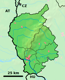
Location of Hamuliakovo in the Bratislava Region Location of Hamuliakovo in Slovakia | |
| Coordinates: 48°02′N 17°15′E / 48.04°N 17.25°E | |
| Country | |
| Region | |
| District | Senec District |
| First mentioned | 1284 |
| Government | |
| • Mayor | Jozef Schnóbl |
| Area | |
• Total | 10.95 km2 (4.23 sq mi) |
| Elevation | 128 m (420 ft) |
| Population (2021)[3] | |
• Total | 2,866 |
| Time zone | UTC+1 (CET) |
| • Summer (DST) | UTC+2 (CEST) |
| Postal code | 900 43[2] |
| Area code | +421 12[2] |
| Car plate | SC |
| Website | www |
Hamuliakovo (Hungarian: Gutor) is a village and municipality located in the Senec District, Bratislava Region, Slovakia.
Geography
The municipality lies at an altitude of 129 metres and covers an area of 10.947 km2.
History
In historical records, the village was first mentioned in 1284. After the Austro-Hungarian army disintegrated in November 1918, Czechoslovak troops occupied the area, later acknowledged internationally by the Treaty of Trianon. Between 1938 and 1945, Hamuliakovo once more became part of Miklós Horthy's Hungary through the First Vienna Award. From 1945 until the Velvet Divorce in 1993, it was part of Czechoslovakia. Since then, it has been part of Slovakia.
Population
According to the 2011 census, the municipality had 1,438 inhabitants. 894 of inhabitants were Slovaks, 504 Hungarians and 40 others and unspecified.[4]
Demographics
Population by nationality:
| Nationality | 1991 | 2001 | 2011 [5] |
|---|---|---|---|
| Hungarians | 69.40% | 55.56% | 35.05% |
| Slovaks | 30.34% | 42.43% | 62.17% |
Twin towns — sister cities
Hamuliakovo is twinned with:[6]
 Deutsch Jahrndorf, Austria
 Kerekegyháza, Hungary
 Rajka, Hungary
See also
References
- ^ "Hustota obyvateľstva - obce [om7014rr_ukaz: Rozloha (Štvorcový meter)]". www.statistics.sk (in Slovak). Statistical Office of the Slovak Republic. 2022-03-31. Retrieved 2022-03-31.
- ^ a b c "Základná charakteristika". www.statistics.sk (in Slovak). Statistical Office of the Slovak Republic. 2015-04-17. Retrieved 2022-03-31.
- ^ "Počet obyvateľov podľa pohlavia - obce (ročne)". www.statistics.sk (in Slovak). Statistical Office of the Slovak Republic. 2022-03-31. Retrieved 2022-03-31.
- ^ http://portal.statistics.sk/files/obce-narodnost.pdf Archived 2014-10-06 at the Wayback Machine [bare URL PDF]
- ^ "Resident Population by nationality by municipalities 2011 Census". slovak.statistics.sk/wps/wcm/connect/d21d8809-a844-4ba0-bb89-961f304365f1/Table_2_Resident_Population_by_nationality_by_municipalities_2011_Census.pdf?MOD=AJPERES&CVID=kojHnpX&CVID=kojHnpX&CVID=kojHnpX. Statistical Office of the SR. Retrieved 2021-09-28.
- ^ "Partnerské obce". obechamuliakovo.sk (in Slovak). Hamuliakovo. Retrieved 2019-09-09.
Genealogical resources
The records for genealogical research are available at the state archive "Státný archiv in Bratislava, Slovakia"
- Roman Catholic church records (births/marriages/deaths): 1672-1896 (parish B)
External links/Sources
![]() Media related to Hamuliakovo at Wikimedia Commons
Media related to Hamuliakovo at Wikimedia Commons
- Official page
- https://web.archive.org/web/20070513023228/http://www.statistics.sk/mosmis/eng/run.html
- Surnames of living people in Hamuliakovo


