Hammett, Idaho
Hammett, Idaho | |
|---|---|
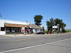
 Shop in Hammett, July 2009 | |
| Coordinates: 42°56′39″N 115°27′56″W / 42.94417°N 115.46556°W | |
| Country | United States |
| State | Idaho |
| County | Elmore |
| Elevation | 2,533 ft (772 m) |
| Time zone | UTC-7 (Mountain (MST)) |
| • Summer (DST) | UTC-6 (MDT) |
| ZIP Code | 83627 |
| Area code(s) | 208, 986 |
| GNIS feature ID | 2804063[1] |
Hammett is an unincorporated community in Elmore County, Idaho, United States. Hammett is located along Interstate 84 Business and Idaho State Highway 78, about 8.5 miles (13.7 km) west of Glenns Ferry. Hammett has a post office with ZIP Code 83627.[2]
History
Hammett's population was 75 in 1960.[3]
See also
References
- ^ a b U.S. Geological Survey Geographic Names Information System: Hammett, Idaho
- ^ ZIP Code Lookup
- ^ World Book Encyclopedia. Vol. I. Field Enterprises Corporation. 1960. p. 27.
External links
![]() Media related to Hammett, Idaho at Wikimedia Commons
Media related to Hammett, Idaho at Wikimedia Commons


