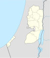
File:West Bank and Gaza Strip location map.svg

Size of this PNG preview of this SVG file: 520 × 599 pixels. Other resolutions: 208 × 240 pixels | 417 × 480 pixels | 667 × 768 pixels | 889 × 1,024 pixels | 1,778 × 2,048 pixels | 639 × 736 pixels.
Original file (SVG file, nominally 639 × 736 pixels, file size: 98 KB)
File history
Click on a date/time to view the file as it appeared at that time.
| Date/Time | Thumbnail | Dimensions | User | Comment | |
|---|---|---|---|---|---|
| current | 11:35, 28 April 2009 |  | 639 × 736 (98 KB) | NordNordWest | area of West Bank back to correct position |
| 02:02, 28 April 2009 |  | 639 × 736 (109 KB) | Fjmustak | 0.85px solid governorate lines (consistent with Israel, Jordan, Lebanon, etc...) | |
| 18:58, 22 April 2009 |  | 639 × 736 (98 KB) | NordNordWest | corr | |
| 02:02, 17 April 2009 |  | 638 × 734 (119 KB) | Fjmustak | Added governorate boundaries | |
| 18:30, 29 November 2008 |  | 638 × 734 (103 KB) | NordNordWest | ||
| 20:05, 19 November 2008 |  | 638 × 734 (118 KB) | NordNordWest | {{Information |Description= {{de|Positionskarte der Palästinensischen Autonomiegebiete bzw. von Westjordanland und Gazastreifen}} Quadratische Plattkarte, N-S-Streckung 115 %. Geographische Begrenzung der Karte: |
File usage
The following 6 pages use this file:
Global file usage
The following other wikis use this file:
- Usage on af.wikipedia.org
- Usage on als.wikipedia.org
- Usage on an.wikipedia.org
- Usage on ar.wikipedia.org
- Usage on az.wikipedia.org
- Usage on ba.wikipedia.org
- Usage on be-tarask.wikipedia.org
- Usage on be.wikipedia.org
- Usage on bg.wikipedia.org
- Usage on bn.wikipedia.org
- Usage on ce.wikipedia.org
- Usage on ckb.wikipedia.org
View more global usage of this file.


