File:Well schematic.pdf

Size of this JPG preview of this PDF file: 583 × 599 pixels. Other resolutions: 233 × 240 pixels | 608 × 625 pixels.
Original file (608 × 625 pixels, file size: 182 KB, MIME type: application/pdf)
File history
Click on a date/time to view the file as it appeared at that time.
| Date/Time | Thumbnail | Dimensions | User | Comment | |
|---|---|---|---|---|---|
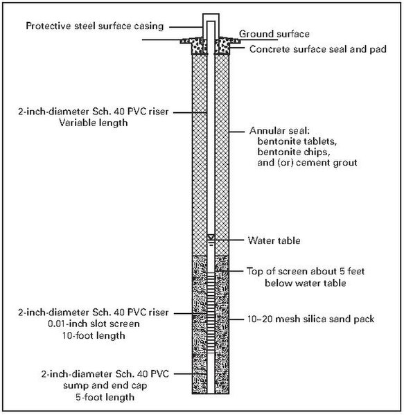
| current | 15:53, 27 May 2024 |  | 608 × 625 (182 KB) | Justaxn | Uploaded a work by Arnold, L.R., Flynn, J.L., and Paschke, S.S. from https://pubs.usgs.gov/publication/ds456 Arnold, L.R., Flynn, J.L., and Paschke, S.S., 2009, Design and installation of a groundwater monitoring-well network in the High Plains aquifer, Colorado: U.S. Geological Survey Data Series 456, 47 p. Figure 8. Schematic diagram of High Plains groundwater monitoring-well completions. with UploadWizard |
File usage
The following 2 pages use this file:

