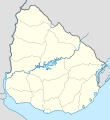
File:Uruguay location map.svg

Size of this PNG preview of this SVG file: 550 × 600 pixels. Other resolutions: 220 × 240 pixels | 440 × 480 pixels | 705 × 768 pixels | 939 × 1,024 pixels | 1,879 × 2,048 pixels | 1,000 × 1,090 pixels.
Original file (SVG file, nominally 1,000 × 1,090 pixels, file size: 62 KB)
File history
Click on a date/time to view the file as it appeared at that time.
| Date/Time | Thumbnail | Dimensions | User | Comment | |
|---|---|---|---|---|---|
| current | 05:43, 16 March 2024 |  | 1,000 × 1,090 (62 KB) | GrandEscogriffe | more correct north-south stretching |
| 01:43, 13 July 2016 |  | 1,000 × 1,056 (74 KB) | Janitoalevic | Added Rincón de Artigas and isla Brasilera disputes and fixed brazilian border in the north of the map. | |
| 14:19, 10 February 2011 |  | 1,000 × 1,056 (77 KB) | Antonsusi | ... | |
| 14:12, 10 February 2011 |  | 1,000 × 1,056 (77 KB) | Antonsusi | try again | |
| 14:10, 10 February 2011 |  | 3,000 × 3,168 (77 KB) | Antonsusi | repair | |
| 07:04, 7 March 2010 |  | 1,000 × 1,056 (114 KB) | Spischot | Default size inceased | |
| 22:26, 25 October 2009 |  | 344 × 363 (139 KB) | Spischot | {{Information |Description={{de|Positionskarte von Uruguay}} Quadratische Plattkarte, Geographische Begrenzung der Karte: * N: 29.86° S * S: 35.19° S * W: 58,71° W * O: 52,89° W {{en|Location map of Uruguay}} Equ |
File usage
More than 100 pages use this file. The following list shows the first 100 pages that use this file only. A full list is available.
- 1930 FIFA World Cup
- 1995 Copa América
- 2009–10 Uruguayan Primera División season
- 2010–11 Uruguayan Primera División season
- Aiguá
- Andresito, Uruguay
- Artigas, Uruguay
- Artigas Airport
- Atlántida, Uruguay
- Baltasar Brum, Artigas
- Barker, Uruguay
- Bella Unión
- Belén, Uruguay
- Biassini
- Bolívar, Uruguay
- Cabo Polonio
- Campamento, Uruguay
- Canelones, Uruguay
- Capitán de Corbeta Carlos A. Curbelo International Airport
- Cardona, Uruguay
- Carmelo, Uruguay
- Casapueblo
- Chamangá
- Chamberlain, Uruguay
- Chuy
- Ciudad de la Costa
- Colonia Airport
- Colonia Palma
- Colonia Valdense
- Colonia del Sacramento
- Conchillas
- Cruz de los Caminos, Tacuarembó
- Cuaró
- Cuchilla Alta
- Durazno
- Egaña
- Fernández, Salto
- Florencio Sánchez, Uruguay
- Florida, Uruguay
- Fomento (resort)
- Fray Bentos
- Ismael Cortinas
- Javier de Viana
- Juanicó
- La Floresta, Uruguay
- La Paz, Canelones
- Las Piedras, Artigas
- Las Piedras, Uruguay
- List of top-division football clubs in CONMEBOL countries
- Los Cerros de San Juan
- Maldonado, Uruguay
- Masoller
- Melo, Uruguay
- Mercedes, Uruguay
- Minas, Uruguay
- Montevideo Uruguay Temple
- Nueva Helvecia
- Nueva Hespérides International Airport
- Nueva Palmira
- Pajas Blancas, Montevideo
- Pan de Azúcar, Uruguay
- Pando, Uruguay
- Paso de los Toros
- Paysandú
- Paysandú Airport
- Pintadito
- Piriápolis
- Progreso, Uruguay
- Punta Colorada
- Punta del Diablo
- Punta del Este
- Quebracho, Paysandú
- Rivera
- Rivera International Airport
- Rocha, Uruguay
- Rosario, Uruguay
- Río Branco, Uruguay
- Salto, Uruguay
- San Carlos, Uruguay
- San Javier, Uruguay
- San José de Mayo
- San Ramón, Uruguay
- Santa Bernardina International Airport
- Santa Lucía, Uruguay
- Santiago Vázquez, Montevideo
- Sarandí del Arapey
- Shangrilá
- Tacuarembó
- Tala, Uruguay
- Tarariras
- Termas del Arapey
- Toledo, Uruguay
- Tomás Gomensoro
- Topador
- Treinta y Tres
- Trinidad, Uruguay
- Uruguayan Primera División
- Villa Soriano
- Villa del Carmen
- Young, Uruguay
View more links to this file.
Global file usage
The following other wikis use this file:
- Usage on af.wikipedia.org
- Usage on als.wikipedia.org
- Usage on an.wikipedia.org
- Usage on ar.wikipedia.org
- Usage on ast.wikipedia.org
- Colonia del Sacramento
- Regueru Mataojito
- Montevidéu
- Minas
- Universidá de la República
- Módulu:Mapa de llocalización/datos/Uruguái
- Módulu:Mapa de llocalización/datos/Uruguái/usu
- Palaciu Llexislativu del Uruguái
- Florida (Uruguái)
- Aguas Corrientes
- Canelones (Uruguái)
- Durazno (Uruguái)
- Trinidad (Uruguái)
- San José de Mayo
- Mercedes (Uruguái)
- Maldonado (Uruguái)
- Rocha (Uruguái)
- Treinta y Tres
- Melo
- Fray Bentos
- Tacuarembó
- Rivera (Uruguái)
- Artigas (Uruguái)
- Paysandú (Uruguái)
- Salto (Uruguái)
- Toledo (Uruguái)
- Progreso (Uruguái)
- Las Piedras (Uruguái)
- La Paz (Canelones)
- Santa Lucía (Uruguái)
- Atlántida (Uruguái)
- Barros Blancos
- Ciudad de la Costa
- Colonia Nicolich
- Empalme Olmos
- La Floresta (Uruguái)
- Los Cerrillos (Canelones)
- Migues
- Montes (Uruguái)
View more global usage of this file.

