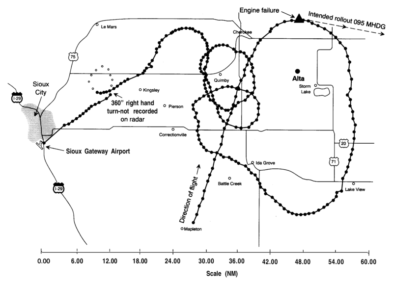
File:UA232map.png

Size of this preview: 800 × 581 pixels. Other resolutions: 320 × 232 pixels | 640 × 465 pixels | 1,024 × 744 pixels | 1,280 × 929 pixels | 2,567 × 1,864 pixels.
Original file (2,567 × 1,864 pixels, file size: 60 KB, MIME type: image/png)
File history
Click on a date/time to view the file as it appeared at that time.
| Date/Time | Thumbnail | Dimensions | User | Comment | |
|---|---|---|---|---|---|
| current | 00:16, 3 September 2017 |  | 2,567 × 1,864 (60 KB) | Mikhail Ryazanov | original resolution from PDF |
| 03:04, 5 May 2010 |  | 1,005 × 702 (29 KB) | Atmoz | {{Information |Description={{en|Radar map from NTSB report into UA 232 crash}} |Source=Transferred from [http://en.wikipedia.org en.wikipedia]; transferred to Commons by User:Atmoz using [http://tools.wikimedia.de/~magnus/commonshelper.php CommonsHelp |
File usage
The following page uses this file:
Global file usage
The following other wikis use this file:
- Usage on fr.wikipedia.org
- Usage on hu.wikipedia.org
- Usage on it.wikipedia.org
- Usage on ja.wikipedia.org
- Usage on nl.wikipedia.org
- Usage on pt.wikipedia.org
- Usage on ru.wikipedia.org

