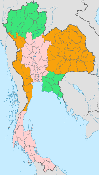
File:Thailand six regions.svg

Size of this PNG preview of this SVG file: 341 × 600 pixels. Other resolutions: 136 × 240 pixels | 273 × 480 pixels | 436 × 768 pixels | 582 × 1,024 pixels | 1,164 × 2,048 pixels | 1,051 × 1,849 pixels.
Original file (SVG file, nominally 1,051 × 1,849 pixels, file size: 1.01 MB)
File history
Click on a date/time to view the file as it appeared at that time.
| Date/Time | Thumbnail | Dimensions | User | Comment | |
|---|---|---|---|---|---|
| current | 04:57, 14 March 2014 |  | 1,051 × 1,849 (1.01 MB) | Paul 012 | Correction: Nakhon Nayok should be in Central Region |
| 10:16, 8 October 2011 |  | 1,051 × 1,849 (1.01 MB) | Paul 012 | {{Information |Description={{en|Map of Thailand showing Bangkok and the 76 provinces coloured by geographic region}} |Source=Based on File:BlankMap-Thailand-provinces.svg |Date=2011-10-08 10:12 (UTC) |Author=*Original by [[User:Nord |
File usage
The following 12 pages use this file:
Global file usage
The following other wikis use this file:
- Usage on bn.wikipedia.org
- Usage on de.wikipedia.org
- Usage on eo.wikipedia.org
- Usage on et.wikipedia.org
- Usage on fr.wikipedia.org
- Usage on gl.wikipedia.org
- Usage on id.wikipedia.org
- Usage on it.wikipedia.org
- Usage on ja.wikipedia.org
- Usage on ml.wikipedia.org
- Usage on pl.wikipedia.org
- Usage on ro.wikipedia.org
- Usage on th.wikipedia.org
- Usage on uk.wikipedia.org
- Usage on ur.wikipedia.org
- Usage on vi.wikipedia.org
