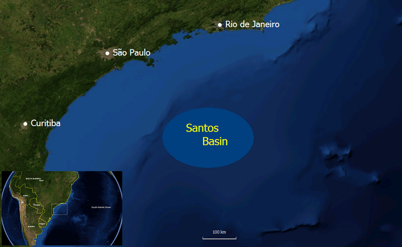
File:Santos basin map.png

Size of this preview: 800 × 492 pixels. Other resolutions: 320 × 197 pixels | 640 × 394 pixels | 990 × 609 pixels.
Original file (990 × 609 pixels, file size: 550 KB, MIME type: image/png)
File history
Click on a date/time to view the file as it appeared at that time.
| Date/Time | Thumbnail | Dimensions | User | Comment | |
|---|---|---|---|---|---|
| current | 23:18, 17 February 2008 |  | 990 × 609 (550 KB) | Mmm~commonswiki | {{Information |Description=Map of the Santos Basin oil producing region off the coast of Brazil |Source=self-made |Date=Feb 17, 2008 |Author= Mmm |Permission= |other_versions= }} Background image is from NASA World Wind, which is public |
File usage
The following 12 pages use this file:
Global file usage
The following other wikis use this file:
- Usage on ca.wikipedia.org
- Usage on es.wikipedia.org
- Usage on incubator.wikimedia.org
- Usage on pt.wikipedia.org
