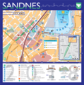
File:Sandnes City Map.png

Size of this preview: 595 × 599 pixels. Other resolutions: 238 × 240 pixels | 477 × 480 pixels | 762 × 768 pixels | 1,017 × 1,024 pixels | 2,033 × 2,048 pixels | 3,008 × 3,030 pixels.
Original file (3,008 × 3,030 pixels, file size: 2.95 MB, MIME type: image/png)
File history
Click on a date/time to view the file as it appeared at that time.
| Date/Time | Thumbnail | Dimensions | User | Comment | |
|---|---|---|---|---|---|
| current | 12:34, 14 May 2022 |  | 3,008 × 3,030 (2.95 MB) | Kevinpaulscarrott | 2022 version 3008 pixelː 6th Edition - Wikimedia Commons Wikivoyage Mapmaking Expedition |
| 09:30, 22 March 2019 |  | 3,008 × 3,034 (1.6 MB) | Kevinpaulscarrott | 2019 version 3008 pixelː Wikivoyage Mapmaking Expedition | |
| 21:11, 17 January 2018 |  | 3,004 × 3,026 (1.61 MB) | Kevinpaulscarrott | 2018 Version 3008 pixelː Wikivoyage Mapmaking Expedition | |
| 20:13, 10 January 2017 |  | 1,750 × 1,765 (838 KB) | Kevinpaulscarrott | 2017 version | |
| 14:07, 2 March 2016 |  | 1,250 × 1,261 (551 KB) | Kevinpaulscarrott | 2016 version | |
| 21:20, 20 December 2014 |  | 1,250 × 1,261 (550 KB) | Kevinpaulscarrott | User created page with UploadWizard |
File usage
The following page uses this file:
Global file usage
The following other wikis use this file:
- Usage on ar.wikipedia.org
- Usage on en.wikivoyage.org
- Usage on lt.wikipedia.org

