File:SUSFlocator.png

Size of this preview: 675 × 599 pixels. Other resolutions: 270 × 240 pixels | 541 × 480 pixels | 910 × 808 pixels.
Original file (910 × 808 pixels, file size: 15 KB, MIME type: image/png)
File history
Click on a date/time to view the file as it appeared at that time.
| Date/Time | Thumbnail | Dimensions | User | Comment | |
|---|---|---|---|---|---|
| current | 00:51, 25 September 2014 |  | 910 × 808 (15 KB) | Porsche997SBS | problem uploading last time; now update should be what is described below |
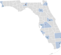
| 00:46, 25 September 2014 |  | 910 × 808 (15 KB) | Porsche997SBS | updating dots to reflect actual location of universities/colleges (rather than the location of home cities) | |
| 08:57, 24 September 2014 |  | 910 × 808 (15 KB) | Porsche997SBS | updating to latest version of this BlankMap (the Monroe County update) | |
| 08:26, 24 September 2014 |  | 910 × 808 (15 KB) | Porsche997SBS | better version: school colors used to distinguish universities; counties containing universities highlighted in high-contrast blue; displays all 12 current members | |
| 22:49, 4 September 2012 |  | 910 × 808 (20 KB) | Presidentman | Added FPU | |
| 07:38, 7 October 2011 |  | 910 × 808 (31 KB) | Porsche997SBS |
File usage
The following 42 pages use this file:
- Advisory Council of Faculty Senates
- Bright Futures Scholarship Program
- Education in Florida
- Florida A&M University
- Florida Atlantic University
- Florida Board of Control
- Florida Board of Governors
- Florida Board of Regents
- Florida Gulf Coast University
- Florida Institute of Oceanography
- Florida International University
- Florida Polytechnic University
- Florida State University
- Florida Student Association
- List of colleges and universities in Florida
- New College of Florida
- State University System of Florida
- State University System of Florida Libraries
- University Press of Florida
- University of Central Florida
- University of Florida
- University of North Florida
- University of South Florida
- University of West Florida
- User:Errorprotector/sandbox
- User:Kookyunii/Education
- User:Meibnotu/sandbox
- User talk:Clariosophic
- User talk:Comayagua99/Archive 1
- User talk:Dirtlawyer1/Archives/2010/April
- User talk:GatorSlayerFSU
- User talk:KnightLago/Archive 5
- User talk:Nemesis63/Archive 1
- User talk:Sirberus
- User talk:Tim Ross
- User talk:Ufgatorman
- User talk:WillMcC
- Wikipedia:WikiProject State University System of Florida
- Template:Invite User State University System of Florida
- Template:StateUniversitySystemofFloridaWikiProject-Member
- Template:State University System of Florida
- Category:State University System of Florida
