
File:Nagpur.png
Size of this preview: 800 × 551 pixels. Other resolutions: 320 × 220 pixels | 640 × 441 pixels | 1,024 × 705 pixels | 1,440 × 992 pixels.
Original file (1,440 × 992 pixels, file size: 282 KB, MIME type: image/png)
Summary
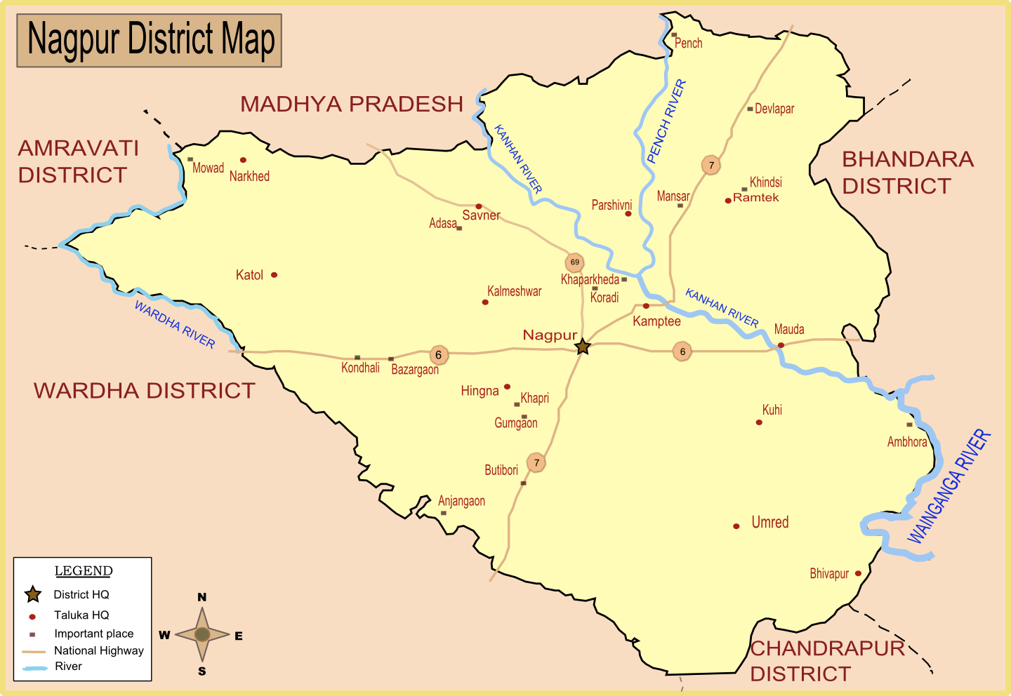
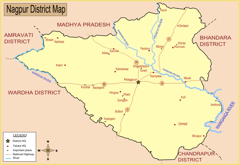
| Description | Map of Nagpur district with major towns and rivers. I have created this map by taking reference from Nagpur district collector's website. |
| Date | |
| Source | Own work |
| Author | Wikigringo |
| Permission (Reusing this file) |
Please site my name in case of reuse or any other use. |
Licensing
I, the copyright holder of this work, hereby publish it under the following licenses:

|
Permission is granted to copy, distribute and/or modify this document under the terms of the GNU Free Documentation License, Version 1.2 or any later version published by the Free Software Foundation; with no Invariant Sections, no Front-Cover Texts, and no Back-Cover Texts. A copy of the license is included in the section entitled GNU Free Documentation License. |
This file is licensed under the Creative Commons Attribution-Share Alike 4.0 International, 3.0 Unported, 2.5 Generic, 2.0 Generic and 1.0 Generic license.
- You are free:
- to share – to copy, distribute and transmit the work
- to remix – to adapt the work
- Under the following conditions:
- attribution – You must give appropriate credit, provide a link to the license, and indicate if changes were made. You may do so in any reasonable manner, but not in any way that suggests the licensor endorses you or your use.
- share alike – If you remix, transform, or build upon the material, you must distribute your contributions under the same or compatible license as the original.
You may select the license of your choice.
File history
Click on a date/time to view the file as it appeared at that time.
| Date/Time | Thumbnail | Dimensions | User | Comment | |
|---|---|---|---|---|---|
| current | 09:33, 24 January 2008 | | 1,440 × 992 (282 KB) | Wikigringo | Added all Taluka headquarters along with major places. Added legend. need to add railway, airport now. Source of this map: Nagpur District collector's website. |
| 08:27, 23 January 2008 |  | 1,053 × 725 (162 KB) | Wikigringo | I have added Ramtek, and also added major national highways in the map. | |
| 08:50, 21 January 2008 |  | 1,041 × 733 (95 KB) | Wikigringo | {{Information |Description=Map of Nagpur district with major towns and rivers. I have created this map by taking reference from Nagpur district collector's website. |Source=self-made |Date=21-Jan-2008 |Author= Wikigringo |Permission=Pl |
File usage
The following 20 pages use this file:
Global file usage
The following other wikis use this file:
- Usage on af.wikipedia.org
- Usage on ar.wikipedia.org
- Usage on bn.wikipedia.org
- Usage on ca.wikipedia.org
- Usage on ceb.wikipedia.org
- Usage on da.wikipedia.org
- Usage on eo.wikipedia.org
- Usage on fa.wikipedia.org
- Usage on fr.wikipedia.org
- Usage on id.wikipedia.org
- Usage on kn.wikipedia.org
- Usage on ml.wikipedia.org
- Usage on mr.wikipedia.org
- Usage on nl.wikipedia.org
- Usage on no.wikipedia.org
- Usage on sat.wikipedia.org
- Usage on sv.wikipedia.org
- Usage on ta.wikipedia.org
- Usage on te.wikipedia.org
- Usage on tr.wikipedia.org
- Usage on vi.wikipedia.org
- Usage on war.wikipedia.org
- Usage on www.wikidata.org
- Usage on zh.wikipedia.org