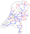
File:Meersporigheid-v1.4.PNG
Meersporigheid-v1.4.PNG (450 × 522 pixels, file size: 41 KB, MIME type: image/png)
File history
Click on a date/time to view the file as it appeared at that time.
| Date/Time | Thumbnail | Dimensions | User | Comment | |
|---|---|---|---|---|---|
| current | 15:47, 23 December 2012 |  | 450 × 522 (41 KB) | Wim1234567890 | Hanzelijn, Betuweroute en HSL added. |
| 09:45, 20 August 2010 |  | 450 × 522 (35 KB) | Crownsteler~commonswiki | updated the map to include the completed work on doubling the tracks from Utrecht to Woerden to 4 tracks. | |
| 12:45, 4 May 2009 |  | 450 × 522 (35 KB) | T Houdijk | Removed Hofpleinlijn/Zoetermeerlijn. Some other little things changed. | |
| 19:25, 17 June 2007 |  | 450 × 522 (35 KB) | Kameraad Pjotr | {{Information |Description={{nl|Kaart waarop het aantal sporen per lijn in het Nederlandse spoorwegnetwerk te vinden is.}} {{en|A map with the amount of rails on a line in the Dutch railway network.}} |Source=Originally fro |
File usage
The following 2 pages use this file:
Global file usage
The following other wikis use this file:
- Usage on de.wikipedia.org
- Usage on hu.wikipedia.org
- Usage on ja.wikipedia.org

