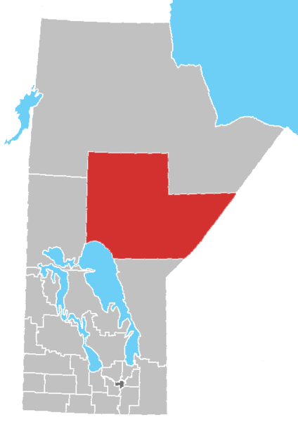
File:Manitoba-census area 22.png

Size of this preview: 424 × 600 pixels. Other resolutions: 170 × 240 pixels | 509 × 720 pixels.
Original file (509 × 720 pixels, file size: 13 KB, MIME type: image/png)
File history
Click on a date/time to view the file as it appeared at that time.
| Date/Time | Thumbnail | Dimensions | User | Comment | |
|---|---|---|---|---|---|
| current | 17:09, 1 August 2012 |  | 509 × 720 (13 KB) | Feuerst | == {{int:filedesc}} == {{Information |Description=Manitoba census area No. 22 |Source={{Derived from|Manitoba-census_areas.png|display=50}} |Date=2012-08-01 16:41 (UTC) |Author=*File:Manitoba-census_areas.png: Qyd *derivative work: [... |
File usage
The following 30 pages use this file:
- Bunibonibee Cree Nation
- Cross Lake, Manitoba
- Cross Lake First Nation
- Division No. 22, Manitoba
- Garden Hill First Nation
- God's Lake First Nation
- Gods Lake Narrows
- Ilford, Manitoba
- Manto Sipi Cree Nation
- Mystery Lake, Manitoba
- Nelson House, Manitoba
- Nisichawayasihk Cree Nation
- Norway House
- Norway House Cree Nation
- Oxford House, Manitoba
- Pikwitonei
- Red Sucker Lake, Manitoba
- Red Sucker Lake First Nation
- Split Lake, Manitoba
- St. Theresa Point First Nation
- Tataskweyak Cree Nation
- Thicket Portage
- Thompson, Manitoba
- Unorganized Division No. 22, Manitoba
- Wabowden
- War Lake First Nation
- Wasagamack
- Wasagamack First Nation
- York Factory First Nation
- Template:MBDivision22
Global file usage
The following other wikis use this file:
- Usage on it.wikipedia.org

