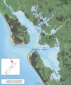
File:Kaipara Harbour location map.png

Size of this preview: 500 × 599 pixels. Other resolutions: 200 × 240 pixels | 400 × 480 pixels | 719 × 862 pixels.
Original file (719 × 862 pixels, file size: 972 KB, MIME type: image/png)
File history
Click on a date/time to view the file as it appeared at that time.
| Date/Time | Thumbnail | Dimensions | User | Comment | |
|---|---|---|---|---|---|
| current | 20:48, 18 March 2021 |  | 719 × 862 (972 KB) | Epipelagic | Uploaded a work by M. Tupe, C. Woods and S. Happy. NIWA project: ARC19501 from [https://knowledgeauckland.org.nz/media/1879/tr2020-008-kaipara-harbour-marine-pest-survey-may-2019.pdf Auckland City Council Technical Report ] with UploadWizard |
File usage
The following page uses this file:
Global file usage
The following other wikis use this file:
- Usage on es.wikipedia.org
- Usage on www.wikidata.org
