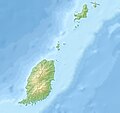
File:Grenada relief location map.jpg

Size of this preview: 634 × 599 pixels. Other resolutions: 254 × 240 pixels | 508 × 480 pixels | 813 × 768 pixels | 1,084 × 1,024 pixels | 1,435 × 1,356 pixels.
Original file (1,435 × 1,356 pixels, file size: 424 KB, MIME type: image/jpeg)
File history
Click on a date/time to view the file as it appeared at that time.
| Date/Time | Thumbnail | Dimensions | User | Comment | |
|---|---|---|---|---|---|
| current | 11:14, 24 December 2010 |  | 1,435 × 1,356 (424 KB) | Uwe Dedering | initial upload |
File usage
The following 32 pages use this file:
- Antoine River (Grenada)
- Balthazar River (Grenada)
- Beauséjour River
- Belmont Formation, Grenada
- Black Bay River (Grenada)
- Bon Accord River
- Calabasse River
- Carriacou
- Carriacou Formation
- Charlotte River (Grenada)
- Chemin River
- Crochu River
- Diamond Island (Grenadines)
- Douce River (Grenada)
- Duquesne River
- Geography of Grenada
- Grand Bay Formation
- Grand Etang Lake
- Great Arm River
- Great River of Grand Bacolet
- List of fossiliferous stratigraphic units in the Caribbean
- Mount Saint Catherine (Grenada)
- Petite Martinique
- River Claire (Grenada)
- River Simon
- Saint Johns River (Grenada)
- Saline Island
- Sauteurs
- Sugar Loaf Island (Grenada)
- Tempé River
- Module:Location map/data/Grenada
- Module:Location map/data/Grenada/doc
Global file usage
The following other wikis use this file:
- Usage on ar.wikipedia.org
- Usage on ast.wikipedia.org
- Usage on ba.wikipedia.org
- Usage on bg.wikipedia.org
- Usage on bn.wikipedia.org
- Usage on bs.wikipedia.org
- Usage on ceb.wikipedia.org
- Usage on ce.wikipedia.org
- Usage on ckb.wikipedia.org
- Usage on cs.wikipedia.org
- Usage on da.wikipedia.org
- Usage on de.wikipedia.org
- Grenada
- Carriacou
- Mount Saint Catherine
- Petite Martinique
- Vorlage:Positionskarte Grenada
- Wikipedia:Kartenwerkstatt/Positionskarten/Nordamerika
- Benutzer:Uwe Dedering
- Ronde Island
- Lake Antoine
- Grand Etang Lake
- Caille Island
- Diamond Island (Grenada)
- Large Island (Grenada)
- Frigate Island (Carriacou)
- White Island (Grenada)
- Saline Island
- Cassada Rocks
- Mushroom Island (Grenada)
- Sandy Island (Carriacou)
- Mabouya Island
- Sister Rocks (Grenada)
- Bird Island (Grenada)
- Sugarloaf (Grenada)
- Green Island (Grenada)
- Sandy Island (Grenada)
- London Bridge (Grenadinen)
- Bonaparte Rocks
- Rose Rock (Grenada)
- Les Tantes
- Palmiste Lake
- Concord Falls
- Annendale Falls
- Seven Sisters Waterfalls
View more global usage of this file.


