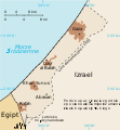
File:Gaza Strip map2 id.svg

Size of this PNG preview of this SVG file: 489 × 599 pixels. Other resolutions: 196 × 240 pixels | 392 × 480 pixels | 627 × 768 pixels | 836 × 1,024 pixels | 1,672 × 2,048 pixels | 725 × 888 pixels.
Original file (SVG file, nominally 725 × 888 pixels, file size: 155 KB)
File history
Click on a date/time to view the file as it appeared at that time.
| Date/Time | Thumbnail | Dimensions | User | Comment | |
|---|---|---|---|---|---|
| current | 09:04, 2 September 2021 |  | 725 × 888 (155 KB) | Ivan Humphrey | Uploaded a work by Gringer, diubah oleh Ivan Humphrey from Versi SVG dari File:Gaza_Strip_map.png, dibuat di Inkscape v. 0.46. dengan bantuan dari GIMP 2.4.7.: * Untuk perbatasan negara: [http://www.ochaopt.org/gazacrisis/admin/output/files/ocha_opt_gaza_crisis_overview.pdf UN Office for the Coordination of Humanitarian Affairs, Gaza-Strip Overview Map] * Untuk nama jalan, pemukiman dll, dari File:Gaza_Strip_map.png * Minimap dibuat menggunaka... |
File usage
The following 3 pages use this file:
Global file usage
The following other wikis use this file:
- Usage on ace.wikipedia.org
- Usage on ckb.wikipedia.org
- Usage on id.wikipedia.org
- Usage on ig.wikipedia.org
- Usage on incubator.wikimedia.org
- Usage on it.wikipedia.org
- Usage on wa.wikipedia.org


