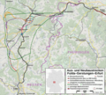
File:Fulda–Gerstungen–Erfurt Karte.png

Size of this preview: 664 × 599 pixels. Other resolutions: 266 × 240 pixels | 532 × 480 pixels | 851 × 768 pixels | 1,134 × 1,024 pixels | 1,852 × 1,672 pixels.
Original file (1,852 × 1,672 pixels, file size: 3.48 MB, MIME type: image/png)
File history
Click on a date/time to view the file as it appeared at that time.
| Date/Time | Thumbnail | Dimensions | User | Comment | |
|---|---|---|---|---|---|
| current | 15:16, 9 October 2021 |  | 1,852 × 1,672 (3.48 MB) | Hbf878 | Fernverkehrshalte |
| 21:56, 8 October 2021 |  | 1,852 × 1,672 (3.47 MB) | Hbf878 | Trassenvarianten | |
| 00:47, 5 October 2020 |  | 1,931 × 1,670 (3.63 MB) | Hbf878 | Ausschnitt | |
| 11:30, 28 July 2020 |  | 2,063 × 1,812 (4.22 MB) | Hbf878 | Suchraum Nord | |
| 21:27, 8 August 2019 |  | 2,063 × 1,812 (4.22 MB) | Hbf878 | Ausschnitt | |
| 17:26, 8 August 2019 |  | 2,235 × 1,812 (4.56 MB) | Hbf878 | minor | |
| 17:00, 8 August 2019 |  | 2,235 × 1,812 (4.56 MB) | Hbf878 | User created page with UploadWizard |
File usage
The following page uses this file:
Global file usage
The following other wikis use this file:
- Usage on de.wikipedia.org

