
File:Dodecanese & Anatolian Coasts, 2016.jpg

Size of this preview: 800 × 532 pixels. Other resolutions: 320 × 213 pixels | 640 × 426 pixels | 1,024 × 682 pixels | 1,280 × 852 pixels | 2,560 × 1,704 pixels | 4,928 × 3,280 pixels.
Original file (4,928 × 3,280 pixels, file size: 1.6 MB, MIME type: image/jpeg)
Summary
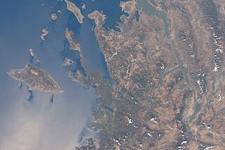
| Description | English: Dodecanese and Anatolian coasts in 2016 |
| Date | |
| Source | https://eol.jsc.nasa.gov/SearchPhotos/photo.pl?mission=ISS048&roll=E&frame=63874 |
| Author | NASA |
| Camera location | | View this and other nearby images on: OpenStreetMap |
|---|
Licensing
This file is in the public domain in the United States because it was created by the Image Science & Analysis Laboratory, of the NASA Johnson Space Center. NASA copyright policy states that "NASA material is not protected by copyright unless noted". (NASA media use guidelines or Conditions of Use of Astronaut Photographs).
Photo source: ISS048-E-63874.
|
File history
Click on a date/time to view the file as it appeared at that time.
| Date/Time | Thumbnail | Dimensions | User | Comment | |
|---|---|---|---|---|---|
| current | 17:32, 8 February 2021 | | 4,928 × 3,280 (1.6 MB) | Ahmetlii | Uploaded a work by NASA from https://eol.jsc.nasa.gov/SearchPhotos/photo.pl?mission=ISS048&roll=E&frame=63874 with UploadWizard |
File usage
The following page uses this file:
Global file usage
The following other wikis use this file:
- Usage on it.wikipedia.org