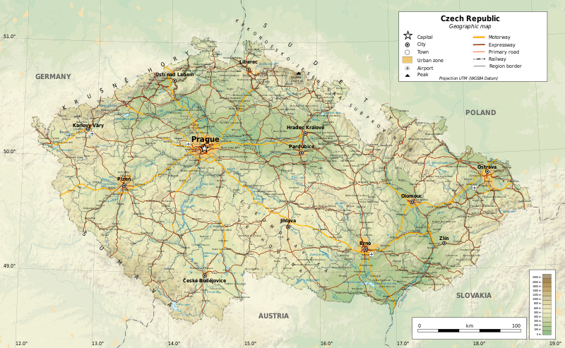
File:CzechRepublic-geographic map-en.svg

Size of this PNG preview of this SVG file: 800 × 493 pixels. Other resolutions: 320 × 197 pixels | 640 × 394 pixels | 1,024 × 630 pixels | 1,280 × 788 pixels | 2,560 × 1,576 pixels | 1,949 × 1,200 pixels.
Original file (SVG file, nominally 1,949 × 1,200 pixels, file size: 14.56 MB)
File history
Click on a date/time to view the file as it appeared at that time.
| Date/Time | Thumbnail | Dimensions | User | Comment | |
|---|---|---|---|---|---|
| current | 23:02, 20 December 2017 |  | 1,949 × 1,200 (14.56 MB) | Ikonact | railways cleaned a bit, town names replaced, legend completed |
| 11:36, 14 December 2017 |  | 1,949 × 1,200 (14.99 MB) | Ikonact | font corrected | |
| 20:20, 29 November 2017 |  | 1,949 × 1,200 (14.99 MB) | Ikonact | geography | |
| 20:03, 21 November 2017 |  | 1,949 × 1,200 (14.98 MB) | Ikonact | final | |
| 21:14, 19 November 2017 |  | 1,949 × 1,200 (14.96 MB) | Ikonact | + railways | |
| 23:07, 15 November 2017 |  | 1,949 × 1,200 (15.31 MB) | Ikonact | + reservoir names, admin borders | |
| 22:03, 14 November 2017 |  | 1,949 × 1,200 (15.22 MB) | Ikonact | + river names, cities outside of CZ deleted | |
| 22:22, 13 November 2017 |  | 1,949 × 1,200 (15.2 MB) | Ikonact | font size | |
| 20:21, 11 November 2017 |  | 1,949 × 1,200 (15.22 MB) | Ikonact | =={{int:filedesc}}== {{Information |description={{en|1=Geographic map of Czech Republic. Geographic limits of the map:}} *S: 48.3° N *N: 51.3° N *W: 11.8° W *E: 19.2° W Projection: UTM |date=2017-11-11 |source={{own}} *Source... |
File usage
The following 3 pages use this file:
Global file usage
The following other wikis use this file:
- Usage on af.wikipedia.org
- Usage on arz.wikipedia.org
- Usage on az.wikipedia.org
- Usage on cs.wikipedia.org
- Usage on fr.wikipedia.org
- Usage on glk.wikipedia.org
- Usage on id.wikipedia.org
- Usage on mt.wikipedia.org
- Usage on uk.wikipedia.org


